
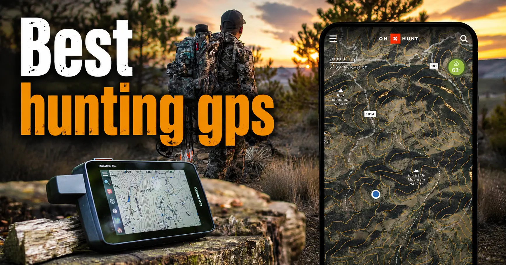

The best hunting GPS is not simply the device with the longest feature list. It should match the terrain, hunt length, weather, navigation skill, map needs, battery strategy, and level of remoteness involved.
This guide compares five user-specified products: three Garmin handheld navigators, one larger-screen alternative, and one dedicated emergency personal locator beacon. The ACR ResQLink 410 RLS is included as an emergency backup rather than a map-based GPS navigator.
A handheld device does not replace navigation knowledge, a paper map, a compass, legal boundary verification, first aid, communication, weather planning, or a shared trip plan.
Quick Picks
- Best Overall: Garmin GPSMAP 65
- Best for Compass and Altimeter Tools: Garmin eTrex 32x
- Best Simple Garmin Option: Garmin eTrex 22x
- Best Large-Screen Alternative: NiesahYan 3.2-Inch Handheld GPS Navigator
- Best Emergency Backup: ACR ResQLink 410 RLS Personal Locator Beacon
Best Hunting GPS Product Comparison Table
| Product | Best For | Key Features | Important Notes | Check Details |
|---|---|---|---|---|
| Garmin GPSMAP 65 | Best Overall | 2.6-inch sunlight-readable color display; Expanded GNSS support with multi-band technology; Routable TopoActive mapping and U.S. federal public-land mapping | Hunters who need a robust, button-operated handheld for public land, dense timber, mountainous terrain, and multi-day trips. | Check Price |
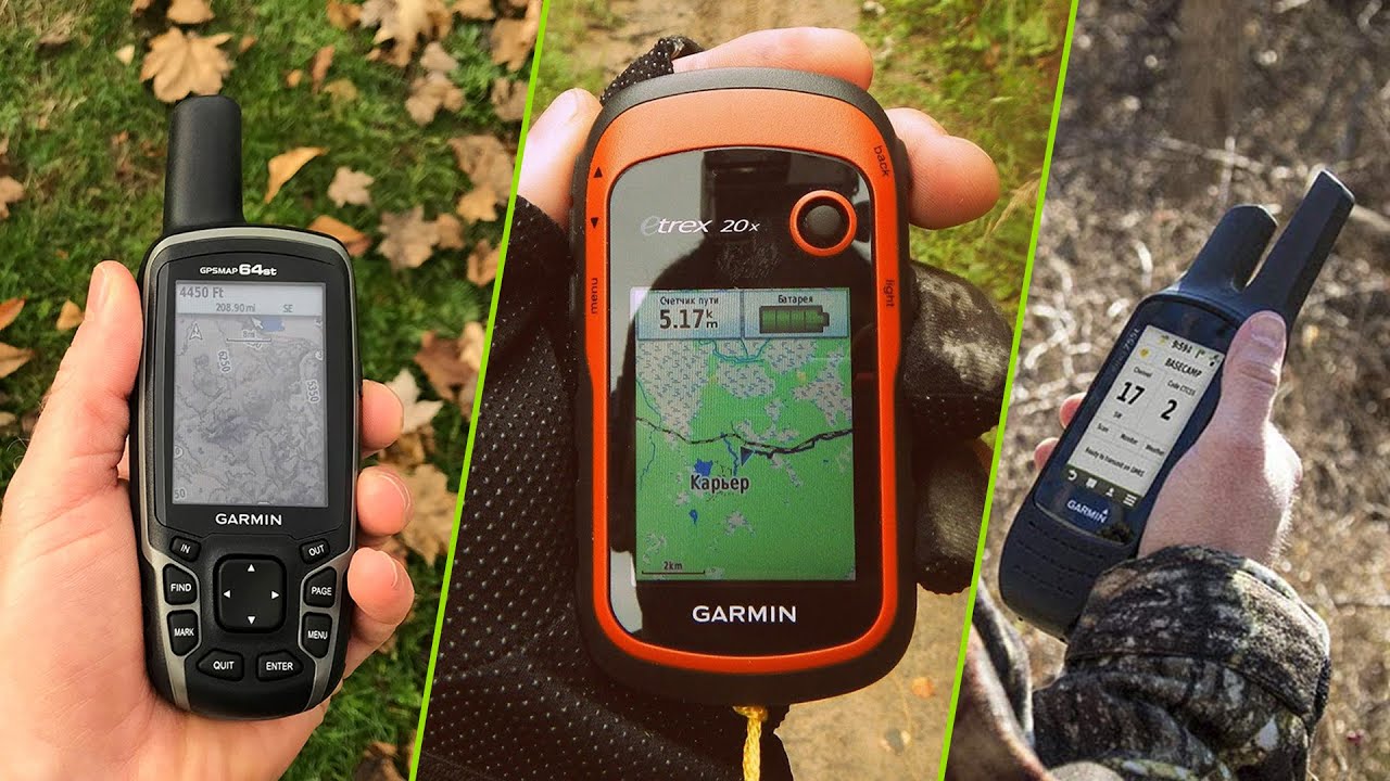
| Garmin eTrex 32x | Best for Compass and Altimeter Tools | 2.2-inch sunlight-readable color display; Preloaded TopoActive maps with routable roads and trails; GPS and GLONASS satellite support | Mobile deer hunters, elk hunters, and backcountry users who want compact navigation with compass and elevation information. | Check Price |
| Garmin eTrex 22x | Best Simple Garmin Option | 2.2-inch sunlight-readable color display; Preloaded TopoActive maps; GPS and GLONASS satellite support | Beginners and budget-conscious hunters who prefer Garmin mapping and a replaceable-battery handheld. | Check Price |
| NiesahYan 3.2-Inch Handheld GPS Navigator | Best Large-Screen Alternative | 3.2-inch sunlight-readable color screen; Physical controls and multi-GNSS support; Three-axis compass and barometric altimeter | Day hunts, vehicle-supported camps, and buyers who want a larger display at a potentially lower cost than premium handhelds. | Check Price |
| ACR ResQLink 410 RLS Personal Locator Beacon | Best Emergency Backup | Return Link Service confirms receipt of the distress signal; No subscription listed as required; GPS, Galileo GNSS, and MEOSAR compatibility | Remote hunters who already have navigation but want a dedicated emergency distress beacon. | Check Price |
Best Hunting GPS Reviews
Best Overall
1. Garmin GPSMAP 65
A button-operated handheld for hunters who prioritize satellite reception and mapping in dense timber, steep terrain, and other difficult environments.
Key Features
- 2.6-inch sunlight-readable color display
- Expanded GNSS support with multi-band technology
- Routable TopoActive mapping and U.S. federal public-land mapping
- Garmin Explore compatibility for tracks, routes, and waypoints
- Replaceable-battery design with a listed battery life of up to 16 hours
Pros
- Strong choice for difficult satellite environments
- Physical buttons are practical with gloves or wet hands
- Useful public-land and route-management tools
Cons
- Shorter listed runtime than the eTrex models in this comparison
- More features can mean a longer learning curve
Field Notes
The GPSMAP 65 is the most capable navigation-focused option in this group for dense forest, steep country, and hunts where reliable positioning matters more than minimizing cost. Carry spare compatible batteries, download maps before leaving service, and practice creating waypoints and navigating back to camp.
Safety and Legal Notes
This device does not replace a paper map, compass, trip plan, or emergency communication tool. Verify maps and property boundaries with official sources before entering or crossing land.
Best For
Hunters who need a robust, button-operated handheld for public land, dense timber, mountainous terrain, and multi-day trips.
Best for Compass and Altimeter Tools
2. Garmin eTrex 32x
A compact handheld that adds a three-axis compass and barometric altimeter to the familiar eTrex mapping platform.
Key Features
- 2.2-inch sunlight-readable color display
- Preloaded TopoActive maps with routable roads and trails
- GPS and GLONASS satellite support
- 8 GB internal memory plus microSD expansion
- Three-axis compass and barometric altimeter
- Listed battery life of up to 25 hours using two AA batteries
Pros
- Compact and easy to carry
- Replaceable AA batteries simplify field resupply
- Compass and altimeter add useful terrain awareness
Cons
- Small screen is less convenient for frequent map panning
- Interface may feel slower and less intuitive than a smartphone
Field Notes
The eTrex 32x makes sense for hunters who want a small device with more orientation tools than the eTrex 22x. It works best when routes, waypoints, and maps are prepared before the hunt rather than edited extensively in the field.
Safety and Legal Notes
Calibrate and test the compass and altimeter according to manufacturer guidance. Carry spare batteries in a protected location and keep a separate map and compass.
Best For
Mobile deer hunters, elk hunters, and backcountry users who want compact navigation with compass and elevation information.
Best Simple Garmin Option
3. Garmin eTrex 22x
A compact, straightforward Garmin handheld suited to hunters who want basic mapping, waypoints, and replaceable batteries without advanced sensors.
Key Features
- 2.2-inch sunlight-readable color display
- Preloaded TopoActive maps
- GPS and GLONASS satellite support
- 8 GB internal memory plus microSD expansion
- Listed battery life of up to 25 hours using two AA batteries
Pros
- Simple feature set for basic navigation
- Compact and lightweight to carry
- AA batteries are easy to replace in the field
Cons
- No three-axis compass or barometric altimeter
- Small display requires more deliberate map use
Field Notes
The eTrex 22x is a practical choice when the main needs are marking camp, parking, trail junctions, stands, glassing points, and recovery locations. Learn the controls at home and preload the maps and waypoints required for the hunt.
Safety and Legal Notes
Do not treat a waypoint as proof of a legal boundary or safe access route. Confirm ownership and closures through official maps and the land manager.
Best For
Beginners and budget-conscious hunters who prefer Garmin mapping and a replaceable-battery handheld.
Best Large-Screen Alternative
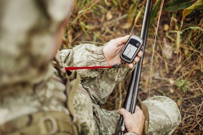
4. NiesahYan 3.2-Inch Handheld GPS Navigator
A non-Garmin alternative listed with a larger color screen, multi-GNSS support, rechargeable power, compass, altimeter, and preloaded U.S. topographic maps.
Key Features
- 3.2-inch sunlight-readable color screen
- Physical controls and multi-GNSS support
- Three-axis compass and barometric altimeter
- Listing states IP66 water resistance
- USB-C rechargeable battery with a listed runtime of up to 36 hours
- Preloaded U.S. topographic maps and 32 GB internal memory
Pros
- Larger screen than the Garmin models listed here
- Rechargeable USB-C power may suit vehicle-based trips
- Compass, altimeter, and preloaded maps add versatility
Cons
- Less established ecosystem and support history than Garmin
- Rechargeable battery cannot be refreshed as quickly as swapping AA batteries
- Buyers should verify map updates, software support, and warranty details
Field Notes
This model may appeal to hunters who value a larger display and rechargeable convenience. Because it comes from a less established GPS brand, test every function, map layer, charging method, and return-to-start workflow well before relying on it in remote terrain.
Safety and Legal Notes
Treat listing claims as specifications to verify after purchase. Carry a power bank only if conditions and charging equipment allow, and retain independent navigation and emergency backups.
Best For
Day hunts, vehicle-supported camps, and buyers who want a larger display at a potentially lower cost than premium handhelds.
Best Emergency Backup
5. ACR ResQLink 410 RLS Personal Locator Beacon
A personal locator beacon designed to send an emergency distress signal. It is not a mapping GPS and should be paired with a separate navigation device.
Key Features
- Return Link Service confirms receipt of the distress signal
- No subscription listed as required
- GPS, Galileo GNSS, and MEOSAR compatibility
- Built-in buoyancy with visible and infrared strobe lights
- Listed five-year battery life and more than 24 hours of emergency operation
- Multifunction attachment clip
Pros
- Purpose-built emergency signaling for remote trips
- No recurring subscription listed
- Compact backup for hunting, boating, and backcountry travel
Cons
- Does not provide maps, routes, or normal handheld navigation
- Emergency-only function is narrower than a satellite messenger
- Registration, testing, battery service, and activation procedures require careful attention
Field Notes
The ResQLink 410 RLS belongs in an emergency plan rather than the navigation column. Carry it where it can be reached quickly, register it as required, and learn the correct test and activation procedures without triggering a false alert.
Safety and Legal Notes
Activate only for a genuine emergency according to official instructions. A beacon does not replace judgment, weather planning, first aid, navigation, or a shared trip plan.
Best For
Remote hunters who already have navigation but want a dedicated emergency distress beacon.
How to Choose the Best Hunting GPS
Choose Navigation, Emergency Signaling, or Both
A mapping handheld helps you view maps, save waypoints, follow routes, and record tracks. A personal locator beacon sends an emergency distress alert but does not guide you around the landscape. Remote hunters may need both functions, whether in separate devices or another carefully selected system.
Match Satellite Performance to the Terrain
Open plains usually provide a broad view of the sky, while dense timber, canyons, steep slopes, and heavy cloud cover can make positioning more difficult. Multi-GNSS and multi-band support may help, but no receiver eliminates all error.
Compare Screen Size and Controls
Small displays reduce bulk but require more scrolling. Larger screens improve readability but may add weight and power demand. Physical buttons are often practical when wearing gloves or working in rain and mud.
Build a Realistic Battery Plan
Replaceable AA batteries are easy to swap during long trips. Rechargeable devices reduce disposable battery use but require a power bank, vehicle, or other charging source. Plan for cold-weather losses, high screen brightness, wireless features, and unexpected delays.
Check Maps, Memory, and Updates
Confirm that the unit supports the map detail and geographic region you need. Preloaded topographic maps may not include every property boundary, closure, trail, or road change. Install and test updates before the hunt.
Understand Compass and Altimeter Features
An electronic compass can show heading while standing still, while a barometric altimeter can help track elevation changes. Both require correct setup and may need calibration. Basic compass knowledge remains essential.
Review Water Resistance and Durability
Read the exact manufacturer rating rather than assuming “rugged” or “waterproof” means unlimited exposure. Inspect battery doors, port covers, cases, and tethers before every trip.
Verify Public and Private Land Information
Mapping data can be useful for planning, but it is not a legal survey. Compare the screen with official agency maps, deeds or county records, posted signs, and land-manager guidance.
Consider Support and Product Ecosystem
Established brands may offer broader map support, manuals, accessories, and service. A lower-cost alternative can still be useful, but buyers should investigate updates, warranty procedures, replacement batteries, and long-term app compatibility.
Understand the Product’s Limits
No GPS guarantees signal, legal access, rescue, safety, or hunting success. The safest system combines practiced navigation, redundant tools, current information, judgment, and a plan shared with someone at home.
Important Hunting and Outdoor Safety Tips Before You Buy
Navigation equipment is a support tool, not a substitute for preparation or emergency judgment.
- Follow local hunting laws, public-land rules, private-land permission requirements, and manufacturer instructions.
- Verify season dates, licenses, tags, legal equipment, visibility-clothing rules, parking, and closures.
- Carry a paper map, compass, first aid, water, weather protection, light, communication, and a trip plan.
- Practice with the device before relying on it in unfamiliar terrain.
- Mark the vehicle and trailhead, then confirm that the saved position is correct.
- Do not use a GPS screen as the sole authority for a property boundary.
- Keep firearms and bows pointed and handled safely while checking electronics.
- Use only approved beacon self-tests and activate a PLB only for a genuine emergency.
Common Mistakes to Avoid
- Buying only on price without checking maps, controls, batteries, and support
- Assuming a larger feature list automatically makes the device easier to use
- Waiting until opening morning to install maps or learn the interface
- Relying on a phone, GPS, or PLB as the only safety system
- Failing to carry spare batteries or a tested charging plan
- Using displayed property lines as unquestionable legal boundaries
- Ignoring cold-weather battery losses and water-resistance limits
- Confusing an emergency beacon with a normal navigation unit
- Failing to register, inspect, or correctly test emergency equipment
- Leaving without a route and expected return time shared with another person
Troubleshooting Common Problems
| Problem | Possible Cause | What to Do |
|---|---|---|
| Slow or lost satellite fix | Dense canopy, steep terrain, poor sky view, or device position | Move to a safer open location, hold the unit correctly, and allow time to reacquire. |
| Battery drains quickly | Cold, high brightness, wireless features, old batteries, or frequent map use | Reduce unnecessary settings, warm spare batteries safely, and test a different approved battery type. |
| Maps are missing | Map not installed, wrong region, disabled layer, or storage issue | Reconnect at home, verify licensing and storage, reinstall correctly, and test before the next trip. |
| Compass heading seems wrong | Calibration, interference, or unsupported electronic-compass behavior | Follow the manual, recalibrate away from metal, and compare with a traditional compass. |
| Boundary does not match signs | Outdated data, map offset, or incorrect dataset | Stop, avoid crossing, and verify with official records or the land manager. |
| Rechargeable unit will not charge | Cable, port, temperature, adapter, or battery fault | Dry and inspect the device, use approved equipment, and contact the manufacturer if the issue continues. |
| PLB self-test fails | Battery, service interval, damage, or incorrect procedure | Do not rely on the beacon; consult the manufacturer or an authorized service provider. |
When to Get Professional Help
Contact the manufacturer for failed updates, map licensing, charging faults, damaged seals, repeated freezes, compass problems, or a failed beacon self-test. Ask the wildlife agency or land manager about access, closures, legal boundaries, and hunting rules. Seek qualified navigation training if you cannot confidently use a map and compass without electronics.
Maintenance and Care Tips
- Inspect the housing, screen, buttons, battery compartment, seals, and tether before each trip.
- Install software and maps at home, then test the device outdoors.
- Remove depleted or leaking batteries and follow manufacturer storage guidance.
- Dry the unit before storage and clean it with approved materials.
- Protect charging ports and use compatible cables and adapters.
- Review saved tracks and delete unnecessary data without removing critical maps.
- Check the PLB registration, battery service date, approved self-test schedule, and attachment system.
Final Verdict
The Garmin GPSMAP 65 is the best hunting GPS in this set for hunters who prioritize difficult-terrain reception and map management. The Garmin eTrex 32x offers a compact balance of mapping, compass, altimeter, and AA power, while the eTrex 22x is the simpler Garmin choice. The NiesahYan handheld provides a larger listed screen and rechargeable design but deserves extra scrutiny for support and updates. The ACR ResQLink 410 RLS is not a navigator; it is the emergency-backup choice for hunters who already have reliable navigation.
Frequently Asked Questions
1. What is the best hunting GPS for most hunters?
The Garmin GPSMAP 65 is the strongest all-around navigation choice in this five-product group because it combines physical buttons, multi-band GNSS support, topographic mapping, and route management. Hunters who prioritize simplicity or lower cost may prefer an eTrex model.
2. Is a handheld GPS better than a smartphone for hunting?
A handheld GPS can offer physical controls, replaceable batteries, rugged construction, and dedicated navigation. A smartphone is often easier for map browsing, but it should not be the only navigation method in remote terrain.
3. Do I still need a paper map and compass?
Yes. Electronics can fail, batteries can drain, and downloaded maps can be incomplete. Carry a current paper map and know basic compass navigation.
4. Which product is best for dense timber?
The Garmin GPSMAP 65 is the best match here because its listing emphasizes expanded GNSS and multi-band technology for difficult locations such as dense forests and steep terrain.
5. Which hunting GPS is easiest for beginners?
The Garmin eTrex 22x has the simplest feature set in this group. Beginners should still practice marking waypoints, following a route, changing batteries, and navigating back to a known point before hunting.
6. Which model has a compass and altimeter?
The Garmin eTrex 32x and the listed NiesahYan handheld include a three-axis compass and barometric altimeter. The GPSMAP 65 model in this comparison is the standard 65, not the 65s.
7. Which option uses replaceable AA batteries?
The Garmin eTrex 22x, eTrex 32x, and GPSMAP 65 use replaceable batteries. Confirm the exact battery type and recommended chemistry in the current manufacturer manual.
8. Which option has a rechargeable battery?
The NiesahYan handheld listing describes a USB-C rechargeable battery. Rechargeable power is convenient, but remote hunters should also plan a safe backup charging method.
9. Is the ACR ResQLink 410 RLS a hunting GPS?
No. It uses location technology for emergency signaling but does not provide normal map navigation. It is a personal locator beacon and should complement, not replace, a GPS navigator.
10. Does a hunting GPS show private property boundaries?
Some devices and map services can display land information, but boundary data may be incomplete or outdated. Verify ownership and legal access through official records, signs, and the land manager.
11. Can a GPS make trespassing impossible?
No. GPS accuracy, map alignment, and boundary data all have limits. Hunters remain responsible for verifying legal access and staying within permitted areas.
12. What screen size is best for hunting?
A larger screen is easier to read and pan, while a smaller screen reduces bulk and battery demand. Choose based on eyesight, glove use, pack space, and how often you study maps in the field.
13. Are physical buttons better than a touchscreen?
Physical buttons are often easier with gloves, rain, mud, or cold fingers. Touchscreens may be faster for map panning, but none of the five default products in this article are selected primarily for touchscreen use.
14. How much battery life do I need?
Plan for the full trip plus a generous reserve. Cold weather, screen brightness, satellite settings, and frequent map use can reduce real runtime.
15. Should I carry spare batteries?
Yes, when the device supports replaceable batteries. Protect spares from moisture and extreme cold, and confirm they are compatible with the manufacturer recommendations.
16. Can I use rechargeable AA batteries?
Many handhelds can use rechargeable AAs, but performance varies by battery chemistry and temperature. Follow the current device manual and test the exact batteries before hunting.
17. How does cold weather affect a GPS?
Cold can reduce battery performance and make controls harder to use. Keep spare batteries protected, reduce unnecessary screen use, and test the device in similar conditions.
18. What is multi-band GNSS?
Multi-band GNSS receives more than one signal frequency from supported satellite systems. It can improve positioning in difficult environments, but it does not eliminate every source of error.
19. What is multi-GNSS support?
Multi-GNSS means the receiver can use more than one satellite constellation, such as GPS, GLONASS, Galileo, or others. Supported systems vary by device.
20. Do topographic maps work without cell service?
Downloaded or preloaded maps can generally be used without cellular service. Confirm the required maps are installed and visible before leaving coverage.
21. Should I update maps before hunting season?
Yes. Review software and map updates before the trip, then test the device afterward. Do not install a major update for the first time at the trailhead.
22. Can I mark tree stands and blinds?
Yes, where legal. Marking a location helps with navigation, but do not publish sensitive coordinates or use the waypoint as proof that stand placement is legal.
23. Can I mark blood-trailing or recovery locations?
A waypoint can help preserve the last known location during legal game recovery. Follow local laws, respect property lines, and seek qualified help when needed.
24. Can a GPS track my walking route?
Most mapping handhelds can record a track. Start the track at a known point, verify recording, and understand how to navigate it before relying on the feature.
25. How accurate is a hunting GPS?
Accuracy changes with satellite view, terrain, canopy, device settings, and atmospheric conditions. Never assume the displayed position is exact enough to define a property line.
26. Does waterproof mean the device can be submerged?
Not necessarily. Water-resistance ratings have specific limits. Check the manufacturer rating and keep ports, battery compartments, and seals properly closed.
27. How should I protect a GPS from rain?
Use the device within its stated rating, inspect seals and covers, tether it securely, and dry it before storage. A protective case can add impact and weather protection.
28. Do I need a screen protector?
A screen protector can reduce scratches, but it may affect visibility or fit. Choose one made for the exact model and ensure it does not interfere with controls.
29. Should I tether the GPS to my pack?
A tether can prevent loss in brush, boats, and steep terrain. Attach it where the device remains accessible without creating a snag or entanglement hazard.
30. What maps are useful for deer hunting?
Topographic contours, water, roads, trails, habitat edges, and verified land ownership information can all help. Use maps to form a plan, then confirm conditions on the ground.
31. What maps are useful for elk hunting?
Elevation, slopes, saddles, drainages, roads, trailheads, water, and access boundaries are especially useful. Match the device and map detail to the scale of the hunt.
32. Is a compact eTrex good for backcountry hunting?
It can be, especially for hunters who prepare routes in advance and value AA batteries. The small screen is less convenient for extensive map analysis.
33. Is the GPSMAP 65 worth the extra complexity?
It can be for hunters who regularly navigate dense timber or steep terrain. Casual users may prefer a simpler eTrex if they do not need the expanded satellite and mapping features.
34. What is the difference between eTrex 22x and 32x?
Both have similar compact mapping features and listed battery life. The eTrex 32x adds a three-axis compass and barometric altimeter.
35. Is the larger NiesahYan screen an advantage?
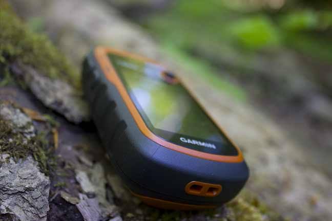
The 3.2-inch display may be easier to read than a 2.2-inch eTrex screen. Buyers should balance that benefit against brand support, map updates, interface quality, and long-term reliability.
36. Should I buy an unfamiliar GPS brand?
Only after checking current reviews, support, warranty, map availability, update process, and return policy. Test every critical function while return options remain available.
37. Does the ACR beacon require a subscription?
The product listing states that no subscription is required. Owners should still complete required registration and follow all current beacon-service instructions.
38. What is Return Link Service?
Return Link Service provides confirmation that the distress alert has been received by the search-and-rescue system. It is not two-way text messaging.
39. Can a PLB replace a satellite messenger?
Not completely. A PLB is designed for emergency distress signaling, while a satellite messenger may offer routine check-ins and two-way messages, typically with a service plan.
40. When should a personal locator beacon be activated?
Only during a genuine emergency when immediate search-and-rescue assistance is needed, following the official instructions and applicable laws.
41. Should I register a personal locator beacon?
Follow the current registration requirements for the country and beacon system. Correct registration can provide rescuers with important owner and emergency-contact information.
42. Can I test a PLB whenever I want?
Use only the approved self-test procedure and schedule described by the manufacturer. Never send a live distress alert as an informal test.
43. Can a GPS replace a trip plan?
No. Leave a route, destination, vehicle description, companions, equipment, and expected return time with a responsible person.
44. What emergency gear should accompany a GPS?
Carry first aid, water, weather protection, fire-starting tools where legal and appropriate, a headlamp, backup navigation, communication, and a realistic trip plan.
45. How should I store a handheld GPS?
Remove leaking or depleted batteries when appropriate, clean and dry the unit, protect the screen, and store it in a cool location according to manufacturer guidance.
46. How often should I inspect my GPS?
Inspect it before every trip. Check batteries, seals, buttons, charging ports, map files, time settings, waypoints, and the tether or case.
47. Why is my GPS losing signal?
Dense canopy, steep terrain, buildings, body position, or poor satellite geometry may contribute. Move to a clearer location when safe, hold the unit correctly, and allow time to reacquire.
48. Why is the displayed direction wrong while standing still?
Some units estimate direction from movement unless they include and use an electronic compass. Calibrate supported compasses and confirm settings before the trip.
49. Why does my battery drain faster than advertised?
Cold, bright backlighting, frequent map redraws, wireless features, old batteries, and satellite settings can reduce runtime. Test realistic use before depending on the stated maximum.
50. Why is the map position different from a property app?
Different map sources, coordinate systems, imagery dates, and boundary datasets can create offsets. Use official property information and physical markers rather than choosing whichever screen appears favorable.
51. Can I use a hunting GPS while boating or marsh hunting?
Yes, if the device and setup suit the water environment. Use a personal flotation device where required, protect the GPS, tether it safely, and follow boating and access laws.
52. Is a GPS useful for public-land hunting?
Yes. It can help organize access points, parking, trails, glassing locations, and routes. It does not replace official rules, closures, signs, or legal boundary verification.
53. Is a GPS useful on private land?
Yes, especially for marking gates, stands, hazards, and agreed boundaries. Obtain permission and confirm the landowner’s rules before entering.
54. What should I do before relying on a new GPS?
Read the manual, update it, install maps, practice at home, navigate a familiar route, create and delete waypoints, replace or recharge batteries, and test backup methods.
55. When should I contact the manufacturer?
Contact support for repeated lockups, charging problems, damaged seals, map licensing issues, failed updates, unclear battery guidance, or any safety-related defect.
Read more: 15 Best Hunting Clothes for Whitetail Deer