
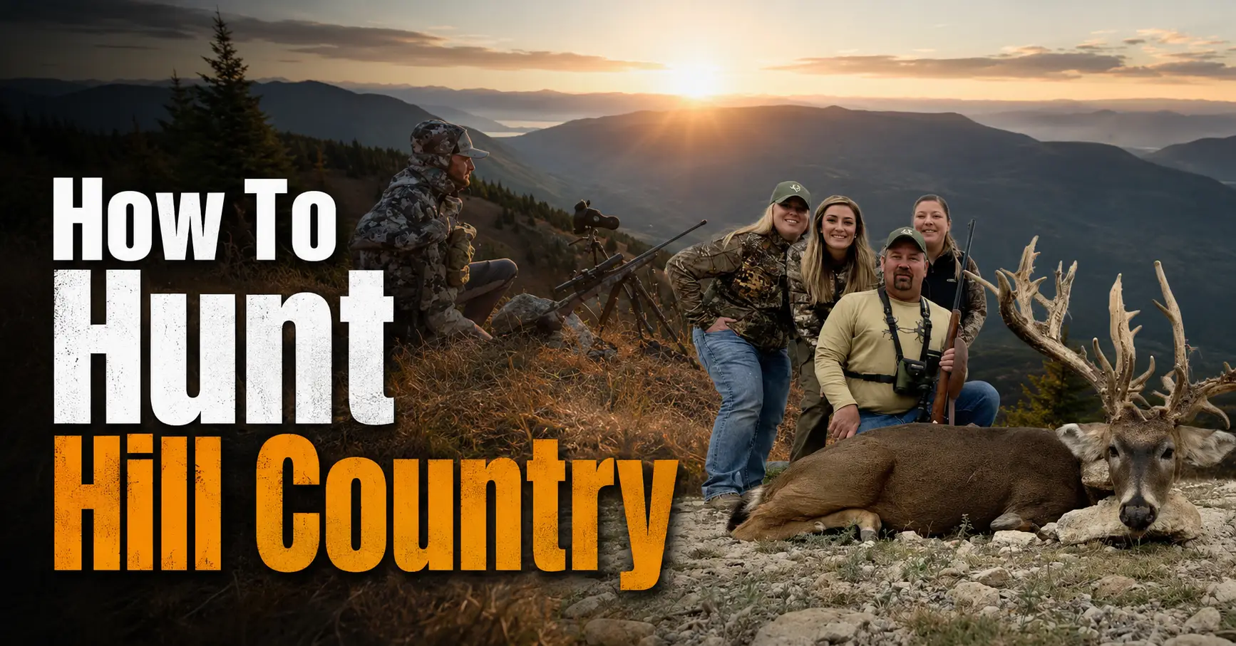

Learning how to hunt hill country is mainly an exercise in understanding terrain, air movement, access, and animal security. In rolling or steep whitetail country, a setup that looks close on a map may require a demanding climb, a quiet sidehill approach, and careful planning for a safe background.
This guide is written for beginners hunting deer in ridges, hollows, wooded slopes, creek systems, and broken public or private land. It covers legal preparation, topographic map reading, scouting, thermals, entry and exit routes, firearm and bow safety, ethical shot decisions, recovery responsibilities, and practical troubleshooting.
Quick Answer
To hunt hill country, first verify current regulations and legal access, then use topographic and aerial maps to identify ridges, points, benches, saddles, draws, cover, food, water, and pressure. Scout for fresh sign and plan an entry route that keeps your wind and thermal flow away from expected deer movement. Set up only where you can positively identify a legal animal and see a reliable backstop; never take a shot at a skylined target. Patient observation, low-impact access, and ethical restraint matter more than forcing a hunt on a promising map feature.
Important Legal and Safety Notice Before You Hunt
Hunting laws vary by country, state, province, county, season, species, property, and hunting method. Check the official wildlife agency and the rules for the exact property before every trip.
- Confirm hunting licenses, permits, tags, season dates, legal hours, bag limits, harvest reporting, and transport rules.
- Verify legal firearms, bows, ammunition, equipment, baiting rules, stand rules, and required visibility clothing.
- Confirm public boundaries or obtain clear private-land permission. Never trespass to reach public land.
- Complete hunter education and hunt with an experienced ethical mentor when possible.
- Treat every firearm as loaded, control the muzzle, keep your finger off the trigger until ready, and identify the target and everything beyond it.
- Never shoot at movement, sound, brush, a road, a home, livestock, a trail, another person, or a skylined animal.
- Carry navigation, water, first aid, communication, and weather protection appropriate for steep terrain.
What Hill Country Hunting Involves
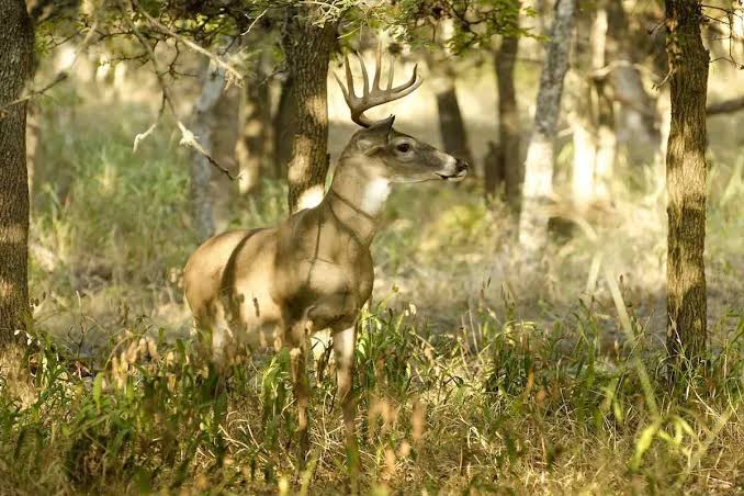
“Hill country” can mean modest rolling timber, deeply cut creek systems, Appalachian-style ridges, Ozark slopes, or similar broken terrain. The common challenge is that elevation shapes where deer can travel efficiently, where they can see danger, how scent moves, and how hunters can approach without being detected.
For a beginner, the goal is not to memorize a single formula. It is to combine five pieces of evidence:
- Legal access: where you can park, walk, set up, and recover game.
- Terrain: routes of least resistance, secure bedding, funnels, and safe shooting backgrounds.
- Habitat: food, water, cover, browse, mast, edge, and seasonal changes.
- Air movement: prevailing wind, terrain deflection, and warming or cooling thermals.
- Pressure: roads, trails, parking, other hunters, hikers, livestock, and recent disturbance.
Terrain Features Every Hill Country Hunter Should Recognize
Ridges and Ridge Tops
Ridges provide relatively efficient travel and may offer steadier wind than low terrain. They are also common human access routes, so evaluate pressure and never shoot across a crest without knowing the background.
Points and Spurs
These fingers of high ground extend from a main ridge. They may provide bedding, sidehill travel, visibility, multiple escape routes, and access to wind from different directions.
Benches
Benches are flatter shelves on slopes. They may hold beds, trails, browse, old logging roads, or staging cover because animals can move without climbing continuously.
Saddles
A saddle is a lower gap between higher ridge sections. It can funnel wildlife, hunters, and wind, making field verification essential before treating it as a setup location.
Draws, Hollows, and Bowls
Depressions collect drainage air and often support thick vegetation, water, and crossings. They can also create unpredictable scent currents and limited visibility.
Creek Bottoms and Crossings
Low routes may connect feeding and bedding areas. They are easier walking for deer but can be noisy, wet, flood-prone, heavily traveled by people, and difficult to hunt with stable wind.
Habitat Transitions
Changes from mature timber to regrowth, hardwoods to conifers, open ground to brush, or dry slope to riparian cover can concentrate food, bedding, and travel.
Terrain Convergence
Locations where a bench, point, draw, edge, and crossing overlap deserve scouting. More features do not automatically mean a huntable setup; wind and access still decide.
How Wind and Thermals Affect Hill Country Deer Hunting
The regional forecast tells you the general wind, but hills bend, accelerate, block, and split it. Temperature-driven air movement adds another layer.
Warming Conditions
As sunlight warms the ground, local air often begins moving uphill. The transition may happen at different times on sunny and shaded slopes, and strong prevailing wind can dominate the pattern.
Cooling Conditions
As slopes cool, denser air often drains downhill into draws and creek bottoms. A setup that was safe earlier may begin sending scent into lower travel routes.
Transition Periods
Dawn, sunset, cloud changes, rain, fronts, and shifting shade can produce unstable or reversing air. These periods require frequent checking rather than assumptions.
Practical Wind Plan
- Predict the regional wind before leaving home.
- Mark likely deer locations and draw a scent cone from every access and setup option.
- Check wind at several elevations while walking in.
- Recheck when sunlight, cloud cover, temperature, or speed changes.
- Leave or move when scent begins reaching expected deer movement.
What You Need Before You Start
Legal Documents
- Current license, permits, and tags
- Property-specific rules and maps
- Written landowner permission where appropriate
- Harvest reporting and transport instructions
Navigation and Communication
- Offline map and compass
- Charged phone or GPS
- Backup battery
- Trip plan shared with a trusted person
Safety Equipment
- First aid kit
- Required blaze orange or visibility clothing
- Headlamp and spare power
- Full-body harness and lifeline for elevated stands
Terrain and Weather Gear
- Supportive boots with traction
- Quiet layering system
- Rain and cold protection
- Water, food, and emergency insulation
Observation Tools
- Binoculars
- Legal wind indicator
- Notebook or mapping app
- Rangefinder where legal and useful
Post-Harvest Plan
- Clean gloves and tools
- Game bags and cooling plan
- Legal recovery assistance
- Vehicle and transport preparation
How to Hunt Hill Country: Step-by-Step Guide
1
Check Current Laws and Property Rules
Confirm the exact species, season, legal hours, license, tags, harvest limits, weapon rules, visibility requirements, reporting, access, stands, trail cameras, baiting, and vehicle restrictions. Save offline copies of rules and maps.
2
Choose the Likely Game Pattern
For whitetails, identify seasonal food, bedding security, water, breeding behavior, weather shelter, and human pressure. Do not assume last year’s pattern is current.
3
Build a Terrain Shortlist on the Map
Mark several ridge points, subtle benches, saddles, draws, creek crossings, habitat transitions, thick cover, food, and likely access routes. Include backup locations for different winds.
4
Confirm Legal Access and Boundaries
Verify parking, gates, roads, private inholdings, safety zones, trails, and neighboring homes. A map pin is not proof of legal access.
5
Scout for Connected, Fresh Sign
Look for multiple clues that form a pattern: active trails connecting secure cover to food, beds positioned with terrain advantage, fresh tracks, droppings, rubs, scrapes, and crossings.
6
Map Wind, Thermals, and Scent Risk
Consider air movement at the parking area, approach, setup, expected deer route, and exit. Avoid a plan that requires the wind to remain perfect through a major temperature transition.
7
Plan a Quiet and Safe Entry
Select the least disruptive legal route, not simply the shortest route. Account for steepness, leaf noise, creek crossings, skyline exposure, loose rock, other hunters, and how you will return after dark.
8
Select a Setup With a Safe Background
Choose a position with concealment, visibility, stable footing, a legal shooting lane, and a reliable backstop. Do not take a position that directs a potential shot toward a crest, road, trail, building, livestock, or unknown hollow.
9
Prepare the Weapon and Stand Safely
Follow manufacturer instructions and hunter education principles. Keep the action open or weapon unloaded as required during transport and climbing. Use a haul line and full-body harness for a tree stand; never climb with a loaded firearm or exposed broadhead.
10
Observe Patiently and Recheck Conditions
Use binoculars for identification, limit unnecessary movement, listen for other users, and check wind throughout the sit. Be prepared to leave when weather or air movement makes the setup poor.
11
Take Only a Legal, Safe, Ethical Opportunity
Act only after positively identifying the species and legal animal, confirming the complete background, and judging the opportunity within your practiced ability. Pass on brush-obscured, rushed, skylined, distant, unstable, or uncertain opportunities.
12
Follow Recovery, Tagging, and Reporting Rules
After a legal harvest, follow required tagging and reporting immediately. Plan recovery around darkness, weather, property lines, steep terrain, and personal limits. Ask for lawful assistance rather than taking unnecessary risks.
13
Care for the Harvest Responsibly
Use clean tools and gloves, cool edible meat promptly, follow disease and transport rules, and avoid waste. Keep the process respectful and non-disruptive around other land users.
Best Time, Place, and Conditions for Hill Country Hunting
| Condition | Potential Advantage | Main Risk | Responsible Response |
|---|---|---|---|
| Cool, stable weather | More predictable comfort and sometimes steadier movement | Thermal transitions still occur | Check airflow repeatedly at different elevations. |
| Light rain | Quieter footing and reduced visibility of movement | Slick slopes, exposure, and recovery difficulty | Use traction, waterproof layers, and conservative routes. |
| Strong steady wind | May overpower weak local thermals | Falling branches, difficult shooting, rapid heat loss | Avoid hazardous timber and stay within practiced limits. |
| Calm conditions | Quiet observation | Unstable, pooling, or reversing scent | Avoid thermal hubs and keep a flexible exit plan. |
| Heavy public pressure | May reveal overlooked escape cover | Other hunters, unsafe crowding, altered deer movement | Increase visibility, communicate, change locations, and never compete for space. |
| Fresh snow | Tracks and recent movement are easier to read | Cold, fatigue, glare, and slippery footing | Shorten the plan and carry winter emergency gear. |
The best place is not necessarily the strongest sign. It is the location where fresh sign, legal access, a workable wind, low disturbance, safe terrain, and a known background overlap.
Hill Country Setup Options
Ridge-Top Setup
Ridge tops may offer easier walking and steadier regional wind, but they are common access routes and can create skylined movement or unsafe shooting backgrounds.
Sidehill Bench Setup
A bench may concentrate bedding and travel. The challenge is reaching it without crossing the trail or sending scent along the same elevation.
Saddle Setup
Saddles can funnel movement, but obvious saddles may also attract other hunters. Scout subtle alternatives and always inspect the complete background.
Creek-Crossing Setup
Crossings can connect multiple terrain systems. Hunt them only when drainage air is understandable, flooding is not a concern, and access does not contaminate the route.
Ground Setup Near Thick Cover
Ground hunting can reduce fall risk and improve mobility, but wear required visibility gear and choose a position where other users can recognize you without compromising a safe field of fire.
Elevated Stand Setup
Where legal, a tree stand may improve visibility. Use a full-body harness and connected lifeline from the time you leave the ground until you return, and inspect the tree and equipment before every use.
Helpful Tips for Better Results
- Scout three to five legal options instead of relying on one “perfect” location.
- Mark dangerous cliffs, steep creek banks, private boundaries, roads, homes, and high-use trails before the hunt.
- Use binoculars, not a firearm scope, to investigate movement.
- Check wind on the route, not only at the final setup.
- Keep an exit route that does not cross expected evening movement.
- Choose subtle terrain features near secure cover rather than only the largest saddle or obvious bench.
- Track hunting pressure as carefully as deer sign.
- Carry less nonessential gear but never remove navigation, water, first aid, lighting, or weather protection.
- Practice from seated, kneeling, standing, and safe elevated angles before the season.
- Pass whenever identity, legality, backstop, range, angle, or recovery is uncertain.
Common Beginner Mistakes to Avoid
- Starting with tactics before regulations: Rules and property access define what is possible.
- Hunting a contour feature without fresh sign: A map feature is only a scouting hypothesis.
- Ignoring the access route: Many setups fail before the hunter arrives.
- Trusting the forecast wind alone: Terrain and thermals can redirect scent.
- Setting up in a thermal hub: Strong sign does not compensate for unpredictable airflow.
- Walking the easiest trail: Deer and other hunters may use it too.
- Taking a skylined shot: A hidden background is never a safe backstop.
- Overestimating fitness: The return climb, darkness, cold, and recovery can be harder than the entry.
- Crowding another hunter: Use a backup spot and preserve safe separation.
- Failing to plan post-harvest work: Tagging, recovery, cooling, transport, and reporting are part of the hunt.
Troubleshooting Common Problems
| Problem | Likely Causes | What to Do |
|---|---|---|
| You are not seeing deer | Old sign, wrong seasonal food, pressure, poor timing, or setup too far from current movement | Rescout fresh sign, compare habitat changes, and rotate to another legal terrain feature. |
| Deer detect you before appearing | Entry route, swirling wind, skyline movement, noise, or scent reaching bedding | Move the access route, wait for a better wind, and reduce movement. |
| Wind is stable at the car but unstable at the setup | Terrain deflection or intersecting thermals | Use a ridge or simpler sidehill location and avoid the low convergence zone. |
| Another hunter is already nearby | Obvious access or terrain funnel | Back out quietly, communicate courteously when appropriate, and use a backup location. |
| The slope is too dangerous | Rain, ice, loose rock, fatigue, poor footwear, or route misjudgment | Turn around and choose safer terrain. No animal is worth a fall or rescue. |
| You cannot confirm the property boundary | Poor map signal, unclear markers, or conflicting information | Do not proceed. Obtain agency or landowner clarification before hunting. |
| Your setup has no safe backstop | Ridge crest, steep drop, road, trail, or hidden bottom beyond the target zone | Relocate or pass every opportunity from that direction. |
| You become disoriented after dark | Route not saved, fog, fatigue, dead battery, or unfamiliar terrain | Stop, stay calm, use map and compass, communicate, and call emergency services if safety is at risk. |
| Recovery would cross private land | Animal movement beyond the legal boundary | Stop at the boundary and follow local rules for contacting the landowner, conservation officer, or authorized tracker. |
Ethical Hunting and Conservation
Ethical hill country hunting means accepting that difficult terrain and unpredictable wind create situations where the responsible choice is to wait, move, or go home.
- Respect wildlife by preparing carefully and taking only opportunities within your ability.
- Obey seasons, limits, property rules, and reporting requirements.
- Respect landowners, other hunters, hikers, workers, livestock, and neighboring homes.
- Avoid waste and have a realistic recovery and meat-care plan.
- Do not damage trees, roads, fences, signs, crops, or habitat.
- Pack out trash and remove equipment as required.
- Support habitat and wildlife management through lawful participation and conservation programs.
When to Get More Training or Professional Guidance
Seek instruction before hunting independently when you have not completed hunter education, are new to firearms or bows, do not understand boundaries, have not practiced from realistic positions, or are unfamiliar with steep remote terrain.
Reliable help can come from:
- Your official state, provincial, or national wildlife agency
- Approved hunter education instructors
- Certified firearm or bow instructors
- Experienced ethical mentors
- Property managers, refuge staff, and conservation officers
- Qualified legal tracking or game-recovery services where allowed
After the Hunt: Follow-Up, Gear Care, and Learning
- Complete required tagging and reporting accurately and on time.
- Clean and dry clothing, boots, optics, stands, and navigation equipment.
- Unload, transport, clean, and store firearms or bows according to law and manufacturer instructions.
- Review the route for hazards and update offline maps.
- Record wind, thermal transitions, sign, sightings, pressure, and access observations.
- Note which assumptions were correct and which require more scouting.
- Improve fitness, shooting practice, first aid, navigation, or meat-care skills before the next trip.
Recommended Hunting Gear and Tools to Consider
You do not need the most expensive equipment. Choose legal, dependable gear based on terrain, weather, hunting method, skill, and emergency needs.
- Legal hunting firearm or bow used according to manufacturer instructions
- Required visibility clothing
- Supportive, waterproof or weather-appropriate boots
- Layered quiet clothing and rain protection
- Binoculars and optional legal rangefinder
- Offline topographic and property maps
- Compass, GPS or phone, and backup battery
- Headlamp and spare batteries
- First aid kit, emergency insulation, whistle, water, and food
- Full-body harness and lifeline for elevated stand use
- Clean gloves, game bags, and cooling equipment for lawful meat care
Final Thoughts
The best way to learn how to hunt hill country is to treat every ridge, bench, saddle, point, and creek system as a testable hypothesis. Verify regulations and access, study the map, scout fresh sign, account for wind and thermals, plan a low-impact route, and choose only setups with safe terrain and a visible backstop.
Success is never guaranteed. A legal, safe day that improves your map reading, judgment, fitness, and understanding of wildlife is meaningful progress. Hunt patiently, pass uncertain opportunities, respect other land users, and make conservation and responsible use of the harvest part of every decision.
Frequently Asked Questions
1. What does hill country hunting mean?
Hill country hunting means pursuing legal game in rolling or steep terrain shaped by ridges, points, benches, saddles, draws, hollows, creek bottoms, and elevation changes. For most readers, the search usually refers to whitetail deer hunting in hilly wooded country.
2. What game species is this guide mainly about?
This guide mainly addresses white-tailed deer because terrain-based bedding, travel, wind, and thermal strategies are commonly associated with hill-country whitetail hunting. Adapt the principles only where they are legal and appropriate for your local species.
3. Do I need a hunting license for hill country deer hunting?
Usually yes, but requirements differ by jurisdiction. Verify licenses, tags, permits, hunter education, season dates, legal hours, bag limits, and reporting rules with the official wildlife agency before hunting.
4. How do I find legal hill country to hunt?
Use official public-land maps, agency property pages, current regulations, and written private-land permission. Confirm boundaries, parking, access corridors, closures, and whether crossing neighboring private land is lawful.
5. What is the best terrain feature for hill country deer?
There is no universal best feature. Saddles, benches, ridge points, sidehill trails, creek crossings, and habitat transitions can all concentrate movement when fresh sign, cover, wind, access, and hunting pressure line up.
6. What is a ridge point or spur?
A ridge point or spur is a smaller finger of high ground extending from a main ridge. Deer may bed, travel, or stage near points because they provide visibility, escape routes, and access to different wind directions.
7. What is a bench?
A bench is a flatter shelf on an otherwise sloping hillside. Benches can offer easier travel, bedding cover, feeding opportunities, and consistent elevation routes.
8. What is a saddle?
A saddle is a low section between two higher points on a ridge. It can act as a path of least resistance for wildlife and sometimes funnels human travel and wind as well.
9. What is a draw or hollow?
A draw or hollow is a drainage-shaped depression between ridges or slopes. These areas can collect cool air, water, vegetation, and travel routes, but they can also produce swirling wind.
10. What is a thermal in deer hunting?
A thermal is local air movement caused by temperature differences. Air often rises as slopes warm and drains downhill as they cool, although clouds, vegetation, water, terrain shape, and regional wind can change the pattern.
11. Do thermals always rise in the morning?
No. Rising morning thermals are a useful general pattern, not a guarantee. Cold pockets, shaded slopes, weather fronts, inversions, and strong prevailing wind can delay, weaken, or reverse local airflow.
12. Why does wind swirl in creek bottoms?
Creek bottoms and hollows can collect drainage air while surrounding ridges redirect the prevailing wind. Intersecting currents may make scent direction unstable, especially during thermal transitions.
13. How can I test wind in the field?
Use a legal, non-littering wind indicator such as unscented powder or lightweight natural material permitted by local rules. Check repeatedly at the parking area, access route, setup height, and during temperature changes.
14. Should I hunt the ridge top or the sidehill?
Choose the position that gives a safe backstop, legal access, fresh sign, concealment, and a wind plan that does not carry scent into expected bedding or travel areas. Ridge tops may have steadier wind; sidehills may offer better deer movement but more complex air currents.
15. Are creek bottoms good places to hunt?
They can be productive travel or feeding areas, but low terrain often has unstable wind and difficult access. Hunt only when airflow, sign, entry, exit, legal shooting direction, and other users make the setup responsible.
16. How do I read contour lines for hunting?
Closely spaced contour lines indicate steep terrain; wider spacing indicates gentler terrain. Look for points, saddles, benches, draws, creek crossings, and places where several features and habitat edges meet.
17. Can a digital map replace boots-on-the-ground scouting?
No. Digital maps help narrow the search, but field scouting confirms trails, tracks, droppings, rubs, scrapes, bedding cover, access difficulty, visibility, hazards, and current human pressure.
18. When should I scout hill country?
Scout when legal and when your presence is least likely to disturb active hunting. Post-season and well-before-season scouting can reveal terrain and historical sign, while limited in-season observation can confirm current movement.
19. What deer sign matters most in hill country?
Prioritize connected sign rather than one isolated clue: tracks, trails, beds, droppings, rubs, scrapes, browse, crossings, and fresh use near terrain funnels, cover, food, and water.
20. How do I tell whether a trail is currently active?
Look for fresh tracks, disturbed leaves, recent droppings, bright rubs, active scrapes where legal to inspect, and repeated camera or observation evidence. Weather and soil conditions affect how old sign appears.
21. Where do deer bed in hill country?
Deer may bed on ridge points, benches, leeward slopes, knobs, thick sidehill cover, or low sheltered areas. Bedding changes with wind, weather, hunting pressure, season, food, and individual behavior.
22. What does leeward mean?
Leeward means the side sheltered from the prevailing wind. Deer may use leeward terrain where air currents, cover, and visibility provide security, but this is a scouting hypothesis rather than a fixed rule.
23. How close should I set up to bedding cover?
Only as close as you can approach and leave legally, safely, and without repeatedly disturbing the area. Beginners often do better starting farther away on a travel corridor and adjusting with evidence.
24. How do I plan a low-impact entry route?
Choose a route that avoids known bedding, feeding, and travel areas; keeps your wind away from expected deer locations; reduces skyline exposure; and avoids dangerous slopes, private property, and other hunters.
25. Should I enter from above or below?
It depends on wind, thermals, terrain, visibility, and deer location. Approaching from below may reduce skyline exposure but can send rising scent uphill; approaching from above may be easier but can disturb ridge travel.
26. What is a thermal hub?
A thermal hub is an area where several draws, slopes, or drainage currents meet. Deer sign may be strong there, but shifting air can make the location difficult to hunt without being detected.
27. How does hunting pressure change deer movement?
Pressure can shift deer toward thicker cover, steeper terrain, less convenient access, different travel times, or alternate routes. Scout human tracks, parking patterns, stands, cameras, and common access points without interfering with others.
28. Is farther from the road always better?
No. Distance alone does not create a good setup. Some productive locations are close to parking but overlooked, while remote areas can receive pressure from determined hunters or have poor habitat.
29. What clothing works best in hill country?
Wear quiet, weather-appropriate layers and supportive boots with traction. Use required blaze orange or other visibility clothing, and pack rain protection, insulation, spare socks, and traction aids when appropriate.
30. How much water should I carry?
Carry enough for the weather, distance, elevation, and duration, plus a reserve. Hill climbing increases exertion, so plan conservatively and know where legal, safe water resupply is possible.
31. What navigation tools should I carry?
Carry an offline map, compass, charged GPS or phone, backup power, and a written route or emergency plan. Know how to use the tools before entering remote terrain.
32. Should I use a tree stand in hill country?
A tree stand can be useful where legal, but uneven ground and steep approaches add risk. Use a full-body harness and lifeline, inspect equipment, follow manufacturer instructions, and keep three points of contact while climbing.
33. Is a ground setup safer than a tree stand?
A ground setup avoids fall exposure but creates other concerns such as visibility to other hunters, limited sight lines, and unsafe shooting angles. Use legal blaze-orange marking where required and never shoot without a safe background.
34. Can I shoot at an animal standing on a ridge crest?
No shot should be taken when the background is unknown. A skylined animal lacks a visible, reliable backstop; pass and wait for a safe opportunity.
35. Why is a downhill shot risky?
Steep angles can hide roads, homes, livestock, trails, or people beyond the target. The apparent ground behind an animal may fall away, so positively identify the full shooting lane and backstop.
36. What are the four basic firearm safety rules?
Keep the muzzle pointed in a safe direction, treat every firearm as loaded, keep your finger outside the trigger guard until ready to shoot, and be certain of the target and what is in front of and beyond it.
37. What bow safety issues matter on steep terrain?
Practice from realistic but controlled angles, use a safe backstop, keep broadheads covered during transport, maintain secure footing, and never take a shot outside your practiced ability or at an unsafe angle.
38. How far should I shoot in hill country?
Only within your verified personal effective range under the actual wind, angle, position, light, and rest available. Terrain can make distance judgment and shooting form harder than range practice.
39. Do I need binoculars?
Binoculars can help identify animals and inspect terrain without pointing a firearm at movement. Use them instead of a riflescope for general observation.
40. What time of day is best?
Early and late movement is common, but legal hunting hours, season, weather, pressure, food, and local deer behavior matter. Midday movement can occur, particularly during breeding periods or after disturbance.
41. How does rain affect hill country hunting?
Light rain may quiet leaves and reduce scent persistence, but heavy rain, cold exposure, slick slopes, flooding, fog, and difficult recovery can create serious risks. Follow forecasts and turn back when conditions become unsafe.
42. How does snow help scouting?
Fresh snow can reveal tracks, travel direction, bedding, and recent use, but it also increases cold, visibility, traction, and navigation hazards. Dress for exposure and avoid unstable slopes.
43. What if the wind changes after I set up?
Recheck it and move or leave when your scent begins reaching expected deer movement or when the change creates an unsafe shooting direction. A backup location is better than forcing a poor setup.
44. What if I am not seeing deer?
Reassess sign freshness, access disturbance, wind, thermal timing, food changes, hunting pressure, and visibility. Scout a different terrain feature rather than repeatedly overhunting one location.
45. What if deer keep detecting me?
Review entry and exit routes, scent flow at multiple heights, noise, skyline movement, setup cover, and timing. The problem may be access rather than the final stand location.
46. How many backup spots should I have?
Have several legal options for different wind directions, pressure levels, weather, and access conditions. Do not crowd another hunter or enter an area when safe separation is uncertain.
47. How do I hunt public hill country responsibly?
Confirm boundaries and property-specific rules, park respectfully, avoid blocking gates, yield space to other users, pack out trash, do not damage trees, and have alternate locations when the area is occupied.
48. How do I hunt private hill country responsibly?
Obtain clear permission, discuss access routes and harvest expectations, respect livestock and gates, avoid damaging roads in wet weather, stay within boundaries, and communicate before and after the hunt.
49. What should I do after a legal harvest?
Follow tagging and reporting rules immediately, recover the animal responsibly, use clean gloves and tools, cool edible meat promptly, comply with transport and disease rules, and avoid waste.
50. When should I stop a recovery effort and ask for help?
Seek legal, experienced help when terrain, darkness, weather, property boundaries, injury risk, uncertain sign, or local tracking rules exceed your ability. Do not trespass during recovery.
51. How can I improve after each hunt?
Record wind, thermal behavior, access route, sign, sightings, hunter pressure, weather, noise, and what changed. Compare notes with maps and adjust one variable at a time.
52. Is expensive gear necessary?
No. Legal equipment, safe weapon handling, reliable navigation, supportive footwear, weather protection, optics, first aid, and practice matter more than premium branding.
53. What is the biggest beginner mistake?
A common mistake is choosing a promising map feature without planning safe access, wind, thermals, backstop, boundaries, and exit. A good location becomes poor when you cannot hunt it responsibly.
54. Can hill country tactics guarantee success?
No. Wildlife movement is variable, and success depends on regulations, habitat, pressure, weather, season, preparation, skill, patience, and ethical decisions.
55. Where can I get reliable local guidance?
Use your official state, provincial, or national wildlife agency; an approved hunter education program; property managers; certified instructors; and experienced ethical mentors familiar with local terrain.
Official Safety and Access Resources
- Hunter-Ed — hunter education and basic firearm or bow safety resources produced with wildlife agencies.
- Texas Parks and Wildlife Hunter Education — an example of an official state hunter education program.
- National Park Service Hunting, Fishing, and Trapping Overview — explains that hunting authorization and property-specific rules vary among federal units.
- Balcones Canyonlands National Wildlife Refuge Hunting — an example of permit-based hunting and property-specific rules in Texas Hill Country.
- Most important: use the current official wildlife agency and property manager for the exact place you plan to hunt.
Read more: How to Hunt Elk on Public Land: A Beginner-Friendly Guide