
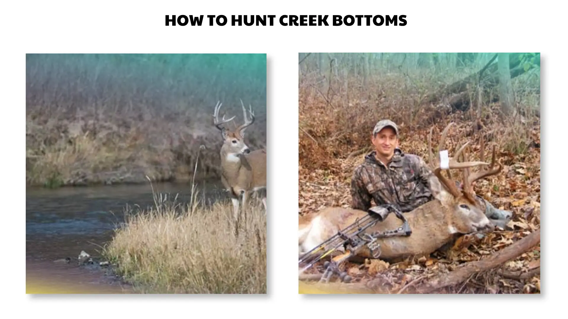

How to read crossings and travel corridors, manage swirling wind and thermals, plan low-impact access, avoid flood hazards, choose a safe setup, and hunt legally and responsibly.
Quick Answer
To hunt creek bottoms, first verify current licenses, tags, seasons, legal methods, land access, and reporting rules. Scout fresh tracks, crossings, trail junctions, benches, tributary mouths, and cover edges, then connect those features to nearby food and bedding. Choose a position with stable wind, a quiet high-ground access route, safe background, and no flood risk. Take only a clearly identified, legal opportunity within your practiced ability, and leave immediately if water or weather becomes unsafe.
Important Legal and Safety Notice Before You Hunt
Hunting regulations and water-access laws vary by country, state, province, county, species, season, weapon, public property, and private ownership. Check the official wildlife agency and land manager before every hunt.
- Carry required licenses, permits, tags, and hunter-education credentials.
- Confirm legal season, shooting hours, bag limits, weapon rules, and reporting.
- Verify land ownership, stream access, easements, and private-land permission.
- Wear required blaze orange or other visibility clothing.
- Identify the target and know the full background.
- Never shoot toward roads, homes, trails, vehicles, boats, anglers, livestock, or unclear movement.
- Use a full-body safety harness in an elevated stand.
- Check flood, weather, dam-release, and water-level conditions.
Habitat and Species Scope
The term “creek bottom” can describe a narrow mountain drainage, forested floodplain, agricultural stream corridor, dry seasonal wash, or broad river-bottom woodland. In much of North America, the main reader intent is hunting white-tailed deer, although creek bottoms can hold mule deer, elk, turkey, hogs, bear, and small game where legal.
This article does not provide local season dates, bag limits, stream-access law, weapon requirements, or universal movement rules. Use current agency publications, a hunter education course, the property manager, and recent field observations.
Why Deer Use Creek Bottoms
Travel Cover
Brush, timber, banks, and low terrain can provide a concealed corridor between bedding and feeding areas.
Water and Food
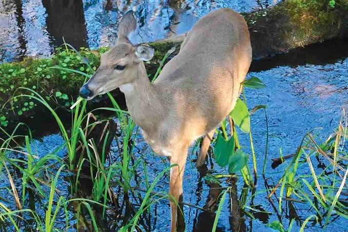
Creek bottoms can provide water, browse, soft mast, hard mast, agricultural edges, and nutrient-rich floodplain vegetation.
Terrain Guidance
Steep slopes, cut banks, tributaries, oxbows, fences, and crossings can narrow movement into predictable routes.
Seasonal Shelter
Low ground may offer shade and wind protection, while thick cover can support bedding. Flooding, insects, and pressure can quickly change its value.
A creek is not automatically a deer magnet. Open banks, constant human recreation, livestock activity, deep water, poor food, or repeated hunting can reduce daylight use. The most useful locations combine current sign with a safe approach and a defensible setup.
High-Value Creek-Bottom Features to Scout
Firm Crossings
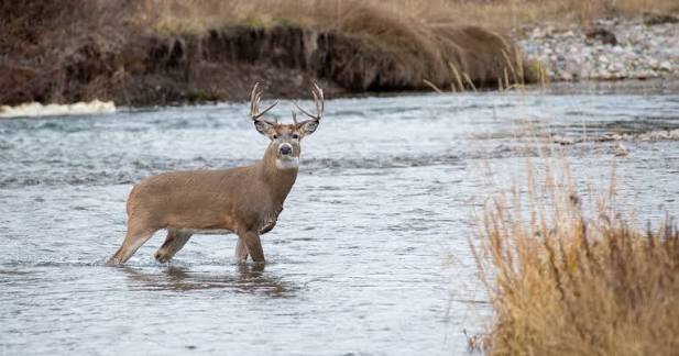
Look for repeated tracks and trails on both banks where footing is shallow, firm, and concealed. A crossing used by deer may not be the easiest place for a hunter to walk.
Tributary Junctions
Where a small drainage meets the main creek, several cover strips may connect. These spots can organize travel but often create swirling wind and multiple approach directions.
Benches Above the Channel
A narrow flat above the floodplain can provide a dry travel route, bedding edge, and more predictable wind than the channel floor.
Cut Banks and Steep Slopes
Impassable or uncomfortable banks may force deer around an end, through a break, or across at a low point. Do not place yourself where a fall, collapse, or poor shooting background creates risk.
Oxbows, Islands, and Beaver Water
Water and thick cover can create funnels around the edge. Conditions can change rapidly after storms, dam activity, or seasonal vegetation growth.
Field and Timber Intersections
A creek that meets a crop field, pasture, clearcut, oak ridge, or brushy bedding area can form a useful transition route. Confirm property boundaries and livestock locations.
How to Read Fresh Creek-Bottom Deer Sign
| Sign | What It Suggests | What Can Mislead You |
|---|---|---|
| Tracks at a crossing | Direction, repeated use, and possible timing after weather | Mud preserves old tracks and concentrates many days of movement |
| Trails on both banks | A connected crossing rather than random shoreline use | Livestock, hikers, hogs, or other wildlife may use the same path |
| Fresh droppings | Recent feeding, travel, or bedding nearby | Weather makes age estimates uncertain |
| Fresh browse | Current food use along the edge | Other herbivores can create similar signs |
| Rubs or scrapes | Seasonal deer communication and travel | Old sign can remain visible for months |
| Beds on high spots | Secure resting cover above water | Entering the area may disturb the pattern |
| Parallel bank trail | Deer may travel the creek without crossing | A trail can be active mainly after legal hours |
Confirm Activity With More Than One Clue
Use tracks plus another form of evidence, such as current browse, droppings, camera data where legal, or direct observation. A muddy crossing can look busy even when most tracks are old.
How to Hunt Creek Bottoms: Step-by-Step Guide
Step 1: Check Regulations, Water Rules, and Access
Verify licenses, tags, season dates, legal hours, bag limits, legal equipment, visibility requirements, stream and boat laws, property boundaries, public access, stand rules, and harvest reporting. Obtain private permission before crossing or recovering on private land.
Step 2: Study the Drainage on Maps
Mark bends, tributaries, benches, steep banks, floodplain width, bridges, roads, homes, public trails, field edges, and likely high-ground exits. Identify upstream dams or watersheds that could affect water level.
Step 3: Scout After Stable Weather
Scout when water is safe and sign can be read. Check several crossings and high benches rather than stopping at the first muddy track. Note recent rain because it can help separate newer tracks from older ones.
Step 4: Connect the Crossing to Food and Bedding
Trace trails from the crossing toward cover, browse, mast, fields, or bedding edges without entering the secure core. A crossing is more useful when it fits a larger movement pattern.
Step 5: Test Wind and Thermals at Ground Level
Check the actual air movement at the setup, bank, and trail. Watch for scent flowing along the drainage, pooling in the bottom, or reversing during temperature changes. Select a backup position on higher ground.
Step 6: Plan a Dry, Quiet Entry Route
Use legal high ground, existing trails, field edges, benches, or logging roads when they reduce disturbance. Avoid wading simply to hide scent. Do not cross swift, deep, icy, muddy, or rising water.
Step 7: Choose a Safe Setup With a Real Backstop
Select a stand, blind, or natural position with clear target identification and safe ground beyond the potential opportunity. Account for people, roads, buildings, boats, livestock, and property lines hidden by brush or bends.
Step 8: Arrive Without Walking the Main Trail
Stay off the crossing and primary travel line. Enter early enough to move carefully, inspect equipment, and settle before expected movement. Do not rush across wet rocks or unstable banks in darkness.
Step 9: Observe Patiently and Identify Completely
Use binoculars to identify animals. Creek-bottom vegetation can hide body position, other deer, people, or structures. Never shoot at sound, antler movement, a partial shape, or unidentified motion.
Step 10: Take Only a Legal, Ethical Opportunity
Confirm the animal is legal, the background is safe, and the opportunity is within your practiced range and ability. Pass on brush-obstructed, moving, steep, distant, or rushed opportunities that create uncertainty.
Step 11: Recover, Report, and Care for the Harvest
Follow official guidance for tagging, waiting, tracking, recovery, reporting, evidence, transport, and disease rules. Keep meat away from creek water and mud, use clean gloves and tools, cool it promptly, and avoid waste.
Wind, Thermals, and Scent in Low Ground
Drainage Wind
Moderate wind may align with the creek and become predictable. At bends, tributaries, bridges, and openings, it can split or curl back. Test continuously.
Morning Transition
Cold air may remain in the bottom until sunlight warms slopes and canopy openings. As the landscape warms, scent can rise or move across the bank unpredictably.
Evening Transition
Cooling air may sink toward the channel and carry scent into trails or bedding below the setup. An evening position on the wrong side of the drainage can fail even when the general forecast looks correct.
Practical Wind Rules
- Choose the wind before choosing the exact tree.
- Keep scent away from both the crossing and likely approach.
- Avoid light-variable conditions when possible.
- Use a backup setup on another bank or higher bench.
- Leave when air repeatedly carries scent toward deer.
Low-Impact Access and Exit Planning
High-Ground Access
A bench or upper edge often provides safer footing, lower flood risk, and less disturbance than the creek channel.
Bridge and Road Access
Public bridges and roads may offer navigation landmarks but can also bring traffic, anglers, walkers, and legal shooting restrictions. Confirm setbacks and access rules.
Water Access
Do not assume a navigable or public creek gives hunting access to adjacent banks. Water law and ownership vary. Boats and wading add cold-water, drowning, transport, and loaded-weapon concerns.
Exit Before Conditions Change
Know a route that does not require crossing the creek. Rising water, darkness, fog, fallen trees, and equipment failure can make the entry route unusable.
Tree Stand, Ground Blind, and Mobile Options
Elevated Stand
- Inspect the tree for flood damage, rot, lean, dead limbs, and root instability.
- Use a full-body harness and remain connected from the ground up.
- Use a haul line for unloaded equipment.
- Follow stand weight, tree-size, and weather limits.
- Do not climb during lightning, high wind, ice, or rising water.
Ground Blind
- Set it above the flood path on stable ground.
- Maintain a safe backstop and complete view of the approach.
- Use required blaze material where applicable.
- Do not block a trail, bank path, boat landing, or emergency route.
- Remove or label it according to land rules.
Natural Ground Position
A natural setup on a high bank or bench can be mobile and low impact. Use stable footing, visibility to other hunters, and a background that controls the projectile path.
Still-Hunting
Move slowly only where you can identify targets and backgrounds. Dense creek vegetation, sharp bends, and recreational users make mobile hunting unsuitable in many areas.
Best Times, Seasons, and Conditions
Early Season
Green browse, water, soft mast, agricultural edges, and shaded bedding may organize movement. Heat, insects, and dense leaves can reduce visibility and increase recovery and meat-care urgency.
Rut Periods
Creek corridors may connect doe bedding and allow covered travel. Focus on crossings, parallel trails, tributary mouths, and funnels, while maintaining safe identification in thick cover.
Late Season
Movement often relates strongly to dependable food and thermal cover. Creek bottoms can connect these resources, but deep cold, snow, and ice increase access hazards.
Light Rain
Damp leaves can reduce noise and make new tracks easier to identify. Heavy rain, upstream storms, or saturated ground may create flood and bank-collapse danger.
Strong Wind
Wind can cover sound but creates falling-limb hazards and unstable stand conditions. Follow equipment limitations and leave when the canopy or balance becomes unsafe.
Flood, Wading, and Water Safety
Creek bottoms can become dangerous faster than many hunters expect. Rain upstream may raise water even when local skies are clear.
- Check official forecasts, radar, flood watches, and dam-release notices.
- Tell someone your location, route, and return time.
- Carry navigation and emergency communication.
- Do not cross water you cannot evaluate clearly.
- Avoid steep undercut banks and unstable logjams.
- Never enter moving water to save hunting equipment.
- Know a high-ground escape route.
- Leave early when water begins rising.
Water Is Not a Scent-Control Tool
Walking a creek can add risk and disturbance without making you scent-free. A safe wind and low-impact dry access route are more dependable.
Creek-Bottom Hunting Gear Checklist
- Current license, tags, permits, and regulations
- Legal hunting method and manufacturer instructions
- Required visibility clothing
- Weather-appropriate layers
- Traction-focused boots
- Map, compass, GPS, or legal mapping app
- Charged phone and backup power
- First aid kit
- Water and food
- Headlamp and spare batteries
- Binoculars
- Wind indicator
- Full-body harness for elevated hunting
- Haul line
- Emergency whistle or communication device
- Gloves and game-care supplies
- Dry bag for critical electronics where useful
- Backup high-ground exit route
Public Land, Private Land, and Creek Boundaries
Public Land
- Use official maps and access points.
- Confirm whether the creek, banks, islands, and adjoining parcels are included.
- Expect anglers, hikers, paddlers, hunters, and workers.
- Follow blind, stand, camera, boat, parking, and removal rules.
- Never use equipment to claim exclusive use of public ground.
Private Land
- Obtain clear permission.
- Discuss crossings, gates, livestock, crops, and vehicle access.
- Ask before trimming vegetation or installing equipment.
- Confirm recovery permission before the season.
- Leave banks, fences, and roads undamaged.
Water Does Not Erase Boundaries
Ownership and public-use rights can depend on navigability, deeds, high-water lines, easements, and jurisdiction. Do not treat the visible creek as a universal public corridor.
Managing Hunting Pressure
Creek crossings are easy to identify and may attract other hunters. Repeated intrusion can shift daylight movement to secondary crossings, higher benches, thick islands, or private ground.
- Scout more than one crossing.
- Use observation before entering the bottom.
- Hunt only suitable winds.
- Rotate setups.
- Avoid checking cameras or sign constantly.
- Communicate respectfully with other users.
- Move rather than create conflict.
Common Creek-Bottom Hunting Mistakes
- Assuming every muddy crossing is currently active
- Walking the primary trail during every scouting visit
- Ignoring scent pooling and thermal shifts
- Entering by the creek without a dry alternate exit
- Hunting inside a flood path
- Using water or brush as an assumed backstop
- Forgetting anglers, paddlers, homes, roads, and livestock
- Placing a stand in a flood-damaged tree
- Crossing private land without permission
- Taking a shot through dense vegetation
- Staying after water begins to rise
- Expecting a creek crossing to guarantee success
Troubleshooting Common Creek-Bottom Problems
| Problem | Possible Cause | Practical Adjustment |
|---|---|---|
| Many tracks but no sightings | Old tracks, nighttime use, pressure, or wrong wind | Use fresh weather events to age sign, observe from high ground, and scout connected benches. |
| Wind changes constantly | Drainage eddies, thermals, tributary junction, or light air | Move to a stable upper edge or wait for stronger, consistent wind. |
| The crossing disappears after rain | Higher water changed the route | Re-scout safe high-bank crossings and do not force access. |
| Deer use several crossings | Wide available habitat or changing food | Focus on the crossing connected to fresh cover, food, and favorable access. |
| Other hunters are nearby | Obvious public-land funnel | Communicate, increase visibility, and move to a legal secondary corridor. |
| The bank is too steep | Erosion or outside bend | Do not climb it with equipment; use a safer legal route or different setup. |
| The ground blind floods | Setup was inside the floodplain | Remove it when safe and relocate above known high-water influence. |
| Trail-camera photos stop | Flooding, pressure, seasonal shift, or theft/damage | Verify legal equipment status and scout sign without excessive intrusion. |
| Property ownership is unclear | Creek channel and map boundaries differ | Stay out until the land manager, records, or landowner confirms legal access. |
| Recovery leads toward water or private land | Animal movement crossed a hazard or boundary | Follow safe recovery practice, obtain permission, and contact the wildlife agency or trained help when needed. |
Ethical Hunting and Conservation
- Obey seasons, limits, access rules, and reporting.
- Complete hunter education and practice before hunting.
- Protect streambanks, wetlands, and riparian vegetation.
- Do not leave stands, trash, line, or damaged equipment.
- Pass unsafe, unclear, or obstructed opportunities.
- Make a serious legal recovery effort.
- Keep harvest and waste out of waterways.
- Respect landowners, other hunters, anglers, paddlers, and wildlife watchers.
- Support science-based habitat and wildlife management.
When to Get More Training or Guidance
Seek an official hunter education course, certified instructor, conservation officer, wildlife biologist, land manager, experienced ethical mentor, or swift-water professional when:
- you are new to firearms, bows, or tree stands;
- you do not understand local access or water law;
- property boundaries are uncertain;
- you cannot identify the species or legal animal confidently;
- the terrain requires difficult water crossings;
- you need help with navigation or flood planning;
- recovery crosses a property line or hazardous area;
- you need legal reporting, disease-testing, or meat-care guidance.
After the Hunt: Gear Care and Learning
- Complete all tagging and reporting.
- Unload, transport, clean, and store equipment safely.
- Dry boots, packs, harnesses, ropes, and optics.
- Inspect equipment exposed to water or mud.
- Record water level, wind, weather, sign, access, and observations.
- Update crossing and property maps.
- Remove temporary equipment as required.
- Plan the next hunt around current conditions, not an old pattern.
Final Thoughts
Learning how to hunt creek bottoms means understanding both their value and their risks. The best setups combine a currently used crossing or travel corridor with stable wind, safe high-ground access, secure background, legal boundaries, and an exit that remains usable if weather changes.
Scout patiently, complete hunter education, follow current regulations, and respect water, wildlife, landowners, and other users. No crossing is worth an unsafe shot, a property violation, or a dangerous attempt to cross rising water.
Frequently Asked Questions: Numbered Q&A
Q1. What is a creek bottom in deer hunting?
A1. A creek bottom is the low ground along a stream, drainage, or seasonal watercourse. It may include floodplain timber, brush, benches, crossings, oxbows, steep banks, and connecting draws. Deer may use these areas for cover, water, food, bedding, and travel, but patterns vary with flooding, hunting pressure, wind, season, and local habitat.
Q2. Why do deer travel through creek bottoms?
A2. Creek bottoms can provide dense cover, easier walking, water, browse, mast, and a protected route between bedding and feeding areas. They also connect different habitat types. Deer do not use every section equally, so current tracks, trails, droppings, rubs, crossings, and direct observation are more useful than the presence of water alone.
Q3. What is the best time to hunt creek bottoms?
A3. Productive timing depends on legal season, weather, water level, food, rut activity, access, and hunting pressure. Mornings can catch deer returning toward cover, while evenings can intercept movement toward feeding areas. Midday activity may increase during certain seasonal phases. Scout the current pattern and obey legal hours.
Q4. Are creek bottoms good during the rut?
A4. They can be useful because bucks may use covered drainages, crossings, and connecting trails while checking bedding areas. However, rut movement is not guaranteed, and pressure or flooding can shift routes. Focus on current sign, safe background, wind, and legal access rather than relying on the calendar alone.
Q5. How do I find a good creek crossing?
A5. Look for firm, gently sloped banks, narrow channels, exposed gravel, tracks on both sides, converging trails, and nearby cover. Avoid assuming the easiest human crossing is the main deer crossing. Confirm repeated use and make sure the setup does not create an unsafe shot toward water, roads, trails, homes, or neighboring property.
Q6. Do deer always cross at the narrowest point?
A6. No. Deer may select a wider shallow area with firm footing, a concealed bend, a fallen bank, an island, or a trail aligned with food and bedding. Water depth, current, bank steepness, ice, human activity, and seasonal flooding can change the preferred crossing.
Q7. How can I scout a creek bottom without disturbing deer?
A7. Use maps first, then scout during a legal low-impact period. Enter with a favorable wind, stay on the edge where possible, check crossings and trail junctions, and avoid repeatedly walking through bedding cover. Mark legal access and safe setups, then leave before creating unnecessary scent and noise.
Q8. What deer sign matters most in a creek bottom?
A8. Prioritize fresh tracks, recently used crossings, droppings, trails with crisp disturbance, fresh rubs or scrapes when seasonally relevant, and browse near cover. Mud can preserve old tracks, so compare layers of sign and use multiple clues before deciding the location is active.
Q9. How can I tell whether creek-bottom tracks are fresh?
A9. Fresh tracks often have sharp edges, visible moisture, recent mud displacement, or leaves pressed into soft ground without debris inside them. Sun, rain, freezing, livestock, and repeated wildlife use can make aging difficult. Treat track age as an estimate and confirm it with other recent sign.
Q10. Should I set up directly over a creek crossing?
A10. Sometimes, but a crossing can be too exposed, too close to swirling air, or positioned over an unsafe background. A setup slightly downwind of the approach trail or at a nearby pinch point may be better. Select a location that provides clear identification and a legal, ethical opportunity within your practiced range.
Q11. What are the best pinch points in creek bottoms?
A11. Useful pinch points may occur where a steep bank, bluff, fence opening, beaver pond, oxbow, narrow strip of cover, field edge, or tributary compresses movement. Verify legal access and safe shooting directions. A map feature becomes meaningful only when fresh sign confirms current use.
Q12. How does wind behave in creek bottoms?
A12. Wind can follow the drainage, spill over ridges, eddy around bends, and shift where tributaries meet. Light winds are often unpredictable. Check conditions at the exact setup and at the expected approach trail. Leave or change positions when scent repeatedly moves toward deer.
Q13. How do thermals affect creek-bottom hunting?
A13. Cool air often settles into low ground, while warming air can rise along slopes. Water temperature, shade, vegetation, and terrain can complicate this pattern. Morning and evening transitions may cause rapid changes, so use a wind indicator and do not depend on a simple uphill-or-downhill rule.
Q14. Why does scent sometimes pool in a creek bottom?
A14. Cool, dense air can settle in low areas, and weak airflow may hold scent near the ground. Dense vegetation and steep banks can also slow or redirect air. If scent remains in the travel corridor, move to a higher bench, a more stable edge, or another legal location.
Q15. What is the best access route to a creek-bottom stand?
A15. Use a route that stays away from bedding and primary trails, remains downwind, avoids noisy crossings, and is safe during current water and weather conditions. An upper bench, field edge, logging road, or existing legal trail may create less disturbance than walking the creek itself.
Q16. Can I walk in the creek to reduce scent?
A16. Water may reduce some ground disturbance, but creek walking is not scent-free and can be dangerous, noisy, illegal, or damaging to habitat. Slippery rocks, deep holes, cold water, unstable banks, and sudden rises are serious risks. Use only legal, safe access and never rely on water as a scent-control guarantee.
Q17. Should I hunt the creek bed or the upper bank?
A17. The best level depends on sign, wind, visibility, flood risk, and safe background. The channel may hide movement but hold unstable air and poor footing. An upper bank or bench may offer better observation and more predictable wind. Select the level that can be reached and hunted safely.
Q18. Are inside creek bends good hunting locations?
A18. Inside bends may have gentle banks, sediment bars, cover transitions, and crossings, while outside bends may have steep cut banks that funnel travel. Either can be productive. Look for current tracks and trails rather than treating every bend as a setup.
Q19. Do tributary junctions attract deer movement?
A19. A tributary junction can bring several cover strips and trails together, creating a travel hub. It can also create complicated wind, dense vegetation, and multiple unsafe shooting directions. Scout both banks and choose a position that provides positive identification and a reliable background.
Q20. How do beaver dams affect creek-bottom deer hunting?
A20. Beaver dams and ponds can reroute trails, create narrow crossings, thicken edge cover, and flood old travel routes. They also create deep water, unstable structures, mud, and hidden channels. Never walk on a dam unless land rules and conditions clearly make it safe; use established dry access.
Q21. How does flooding change deer movement?
A21. Flooding can cover trails, force deer onto higher benches, create new crossings, and isolate low-ground bedding. Never enter a floodplain during rising water, heavy rain, dam release, or a flash-flood warning. Re-scout after water recedes because the previous pattern may no longer exist.
Q22. Is creek-bottom hunting dangerous after heavy rain?
A22. It can be. Water can rise quickly, banks can collapse, bridges can wash out, and mud can make climbing or stand access unsafe. Check upstream weather and official warnings, not only local rainfall. Avoid low ground when flooding is possible and carry a safe alternate exit.
Q23. What footwear is best for creek-bottom hunting?
A23. Choose boots for the expected mud, water, rocks, temperature, and walking distance. They should provide traction and ankle support without encouraging unsafe wading. Waterproof footwear can help in shallow wet ground, but it does not make deep, swift, icy, or contaminated water safe.
Q24. Is a tree stand effective in a creek bottom?
A24. A stand can improve visibility above brush, but suitable trees may be leaning, soft, flood-damaged, or unstable. Inspect the tree and equipment, use a full-body harness connected from the ground up, follow manufacturer rules, and avoid climbing during strong wind, ice, lightning, or flood conditions.
Q25. Is a ground blind effective near a creek?
A25. A blind can work on a dry bench, crossing approach, or cover edge with a safe background. Do not place it in a flood path, public trail, unstable bank, or area that blocks access. Follow public-land rules for labeling, visibility, duration, and removal.
Q26. Can I still-hunt through a creek bottom?
A26. Still-hunting may work when wet leaves reduce noise and visibility is sufficient, but dense brush and winding terrain can make target identification difficult. Move slowly, stop often, use binoculars to identify wildlife, and never aim at sound or movement that is not clearly identified.
Q27. How should bowhunters set up in creek bottoms?
A27. Bowhunters should select close, open opportunities, practice from realistic angles, know their personal effective range, and handle broadheads safely. Avoid shooting through brush, across property boundaries, over unknown water depth, or at steep angles beyond practiced ability.
Q28. How should firearm hunters set up in creek bottoms?
A28. Firearm hunters need a secure earthen background and a clear view of what lies beyond the target. Low ground may contain roads, homes, trails, livestock, anglers, paddlers, or other hunters hidden by vegetation. Never use water, brush, or a distant bank as an assumed safe background.
Q29. Should I wear blaze orange in a creek bottom?
A29. Wear all visibility clothing required by current regulations and consider additional visibility where other hunters or recreationists may be present. Dense vegetation, fog, and low light reduce visibility. Legal requirements vary by season, method, and location.
Q30. Can I use a creek as a property boundary?
A30. Only when official property records and on-the-ground boundaries confirm it. Streams can move, split, or have ownership rules that differ from the visible channel. Use current official maps, land-manager information, survey markers, and landowner permission; do not guess.
Q31. Can I cross private land to reach a public creek bottom?
A31. No, unless you have legal access or clear landowner permission. Public land along a creek does not automatically provide legal access across private ground. Verify easements, roads, parking, water-access rules, and boundaries before the hunt.
Q32. Can I hunt from a boat or while wading?
A32. Rules for hunting from boats, watercraft, or water vary widely and may depend on species, motor status, loaded weapons, public-water law, and distance from buildings or roads. Do not do so without specific official confirmation, proper equipment, and safe conditions.
Q33. Do deer bed in creek bottoms?
A33. They may bed in thick floodplain cover, elevated islands, brushy points, logjams, cane, conifers, or benches above the channel. Flood risk, human access, temperature, insects, and pressure affect bedding. Avoid walking directly through suspected bedding during the season.
Q34. Are creek bottoms better in hot weather?
A34. Shaded low ground and nearby water may offer cooler conditions, but deer do not need to stand beside open water all day. Insects, human use, stagnant air, and food availability also matter. Hunt current sign and remain alert for heat stress, mosquitoes, ticks, and dehydration.
Q35. Are creek bottoms better in cold weather?
A35. Protected drainages may reduce wind and connect bedding with late-season food, but cold air can settle and create difficult thermals. Ice and snow can make crossings and banks hazardous. Adjust clothing and access, and do not risk a fall or cold-water immersion.
Q36. Why am I seeing tracks but no deer?
A36. Tracks may be old, made at night, created by multiple species, or concentrated because mud records every crossing. Your wind, entry route, hunting pressure, water-level change, or nearby food may also shift daylight movement. Confirm freshness and scout higher benches or connected cover.
Q37. How do I avoid overhunting a creek crossing?
A37. Hunt only when wind and access are favorable, rotate between locations, minimize camera and scouting visits, and avoid walking the crossing. Watch for movement shifting to parallel trails or other crossings. Give the area time to recover after disturbance.
Q38. What should I do if the creek rises while I am hunting?
A38. Leave early by the safest high-ground route. Do not attempt a crossing that is deeper, faster, muddy, icy, or less visible than when you entered. Call emergency services if you become trapped by rising water. Equipment is not worth risking drowning or injury.
Q39. What should I do after a successful harvest near a creek?
A39. Follow immediate tagging, reporting, validation, transport, and recovery rules. Keep meat and equipment out of the water, prevent contamination, use clean gloves and tools, and cool the harvest promptly. Obtain permission before crossing any boundary during recovery.
Q40. Where can I verify creek-bottom hunting rules?
A40. Use the official wildlife agency and the land manager for the exact property. Confirm licenses, tags, seasons, legal hours, weapons, orange requirements, water and boat rules, public access, stand placement, chronic-wasting-disease restrictions, reporting, and transport regulations.