
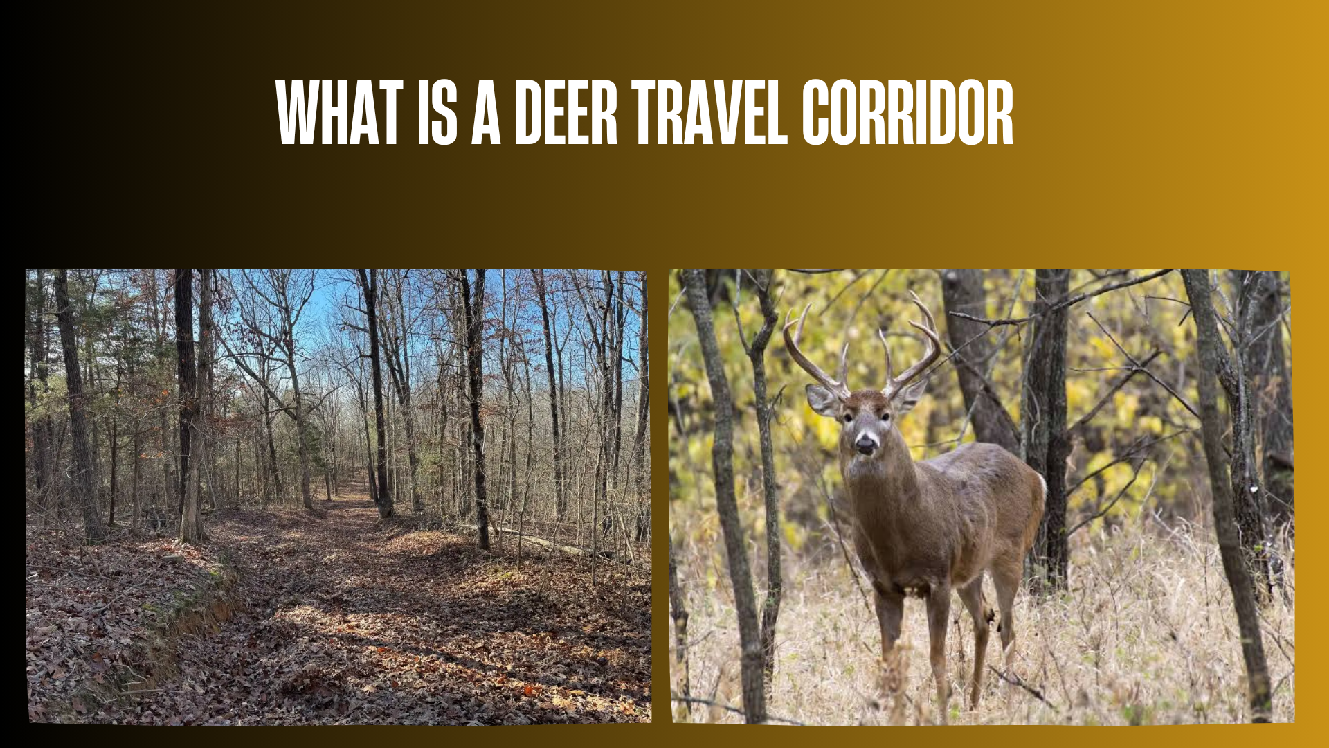

A deer travel corridor is a route or band of habitat that deer commonly use to move between places they need, such as bedding cover, food, water, seasonal range, and secure escape cover. It may be a distinct trail through brush, but it can also be a broader strip of timber, creek drainage, saddle, field edge, hedgerow, bench, or other feature that makes movement easier or safer.
Understanding deer travel corridors can help hunters and wildlife watchers interpret movement instead of reacting to a single track or trail. A corridor does not guarantee that deer will appear at a particular time. Use can change with season, food availability, wind, weather, breeding behavior, predators, hunting pressure, farming activity, and other human disturbance.
Quick Answer
A deer travel corridor is a commonly used movement route connecting important habitat areas. Deer often favor routes that combine efficient travel with cover, favorable terrain, and a lower sense of risk. Hunters can identify likely corridors by studying maps and confirming several kinds of field sign, such as tracks, trails, droppings, rubs, beds, crossings, and repeated trail-camera observations. Before scouting or hunting one, verify current regulations, land boundaries, access rules, equipment restrictions, and permission requirements with the relevant wildlife and land-management authorities.
Deer Travel Corridor at a Glance
| Feature | What It Means | What to Look For |
|---|---|---|
| Purpose | Connects bedding, feeding, water, seasonal habitat, or secure cover | A logical route between two or more resources |
| Shape | Can be a narrow trail or a broad habitat strip | Creek bottoms, benches, saddles, edges, fence gaps, brushy strips |
| Evidence | Repeated use matters more than one isolated sign | Tracks of different ages, worn paths, droppings, rubs, repeated images |
| Timing | Use can be daily, seasonal, weather-dependent, or pressure-dependent | Direction and timing of observations across several days or weeks |
| Hunter value | Helps organize scouting and predict likely movement | A safe, legal observation point with low-impact access |
| Limitation | A corridor is a probability, not a promise | Changes after pressure, crop harvest, food shifts, storms, or rut activity |
What Makes a Route a Corridor Instead of Just a Deer Trail?
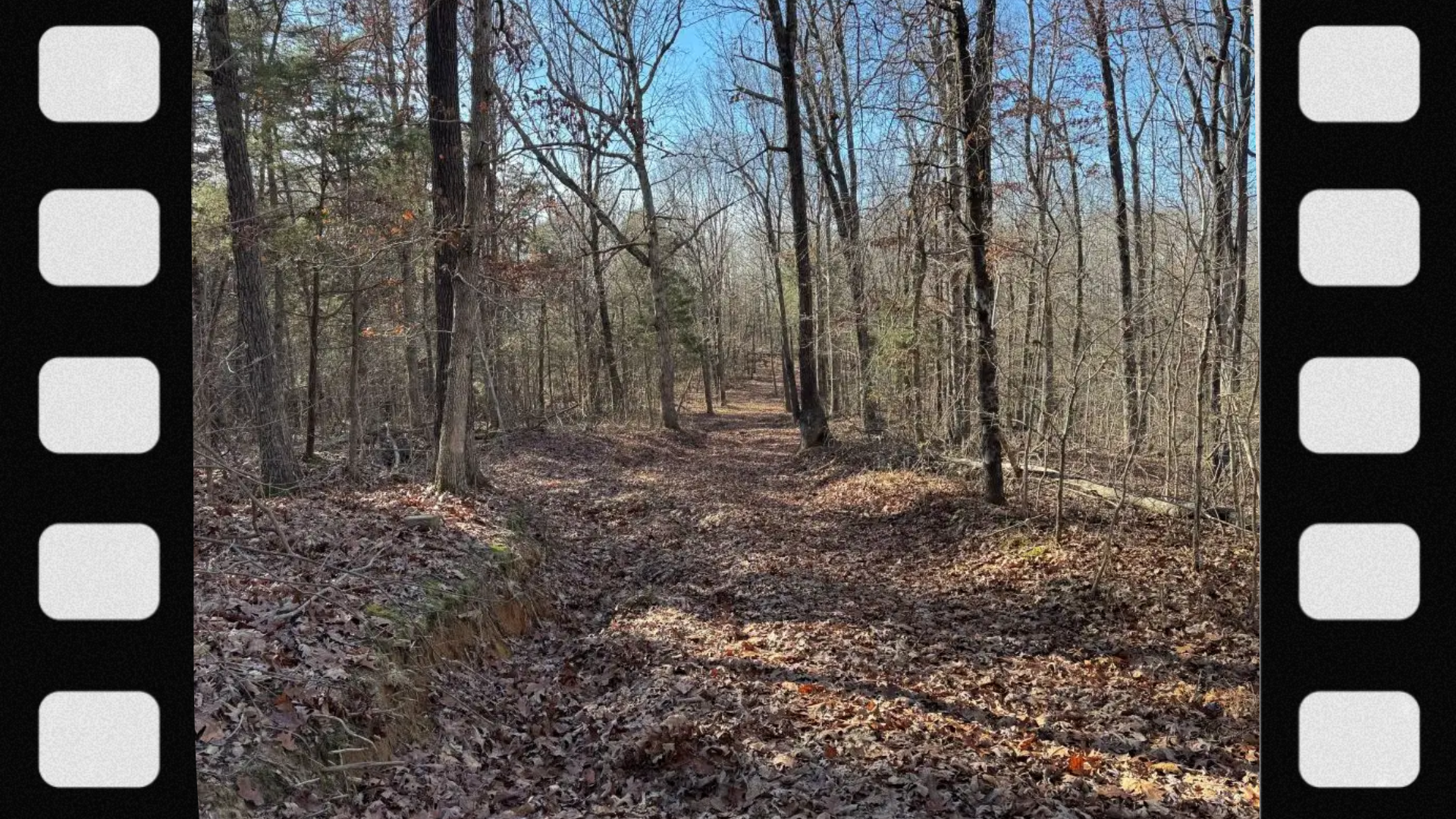
A deer trail is physical evidence that one or more animals have walked a particular line. A travel corridor is the larger movement system that explains where that line goes and why deer use it. Several parallel trails may belong to one corridor, and a corridor may remain important even when no single path is deeply worn.
Think of the difference this way: a trail is the footprint on the ground; a corridor is the connected route through the landscape. A useful corridor usually links habitat features or funnels movement through terrain. It may contain primary trails, secondary trails, crossings, staging cover, and alternate paths deer use under different wind or pressure conditions.
Why Deer Use Travel Corridors
Efficient movement
Deer often use terrain that allows relatively easy movement. A bench across a steep slope, a low saddle between ridges, a gentle creek bottom, or an old roadbed can require less effort than pushing through the steepest or thickest nearby ground.
Security cover
Brush, young forest, tall grass, conifers, timber edges, and broken terrain can provide visual screening. Deer may prefer a covered route over a shorter exposed one, particularly during daylight or in areas with frequent human activity.
Connections between daily needs
Many local corridors connect bedding cover with evening food sources or lead from feeding areas back toward daytime cover. Water, mineral needs, thermal cover, and escape terrain can also shape routes. The same deer may use more than one corridor depending on wind, time, disturbance, and destination.
Terrain guidance
Topography can concentrate movement. Saddles, benches, creek crossings, narrow strips of cover, fence openings, and gaps around obstacles can act as funnels. Deer are capable of moving almost anywhere, but they frequently choose routes that combine convenience and security.
Seasonal and migratory needs
In some regions, deer move between seasonal ranges. These landscape-scale migration corridors differ from the short daily routes hunters often call travel corridors. Both are important: one connects seasonal habitat across a large area, while the other may connect bedding and feeding cover within a home range.
Common Types of Deer Travel Corridors
| Corridor Type | Why Deer May Use It | Field Clues | Main Variable |
|---|---|---|---|
| Brushy field edge | Connects food with nearby cover | Parallel trails just inside the cover | Crop, mowing, and hunting pressure |
| Creek or drainage | Offers cover, water, gentle grades, and crossings | Tracks at muddy crossings and trails along banks | Water level and flooding |
| Ridge saddle | Provides a lower crossing between high points | Multiple trails converging near the low spot | Wind and regional topography |
| Hillside bench | Creates a flatter route across a slope | A side-hill trail with repeated tracks | Thermals, wind, and bedding location |
| Hedgerow or timber strip | Connects isolated cover across open ground | Tracks, crossings, and trails inside the strip | Human activity and cover density |
| Fence gap or obstacle bypass | Offers an easy crossing around a barrier | Hair, tracks, worn soil, or repeated images | Fence condition and alternate openings |
| Logging road or old roadbed | Provides easier walking and edge browse | Tracks on the road and entry trails from cover | Vehicle use and recent disturbance |
| Cover pinch point | Concentrates movement where secure habitat narrows | Several routes merging through a narrow band | How much alternate cover remains available |
How to Identify a Deer Travel Corridor
- Start with a map. On aerial imagery, identify likely bedding cover, food sources, water, timber strips, drainages, edges, and barriers. On a topographic map, look for saddles, benches, ridge points, creek bottoms, and manageable slope transitions.
- Draw the logical connections. Ask how a deer could move between those resources while staying in cover and avoiding unnecessary effort or exposure.
- Check property boundaries and access. A promising line on a map may cross private land, a closed area, a road, or a refuge where access or hunting is restricted.
- Ground-truth the route. Look for several signs rather than one track. Note trail width, track freshness, droppings, hair, rubs, scrapes, beds, browsed vegetation, and crossing points.
- Determine where the route leads. Follow only where legal and low-impact. A trail that ends at a feeding area tells a different story than one connecting two patches of bedding cover.
- Monitor timing. Legal trail-camera use, distant observation, snow tracking, or repeated low-impact checks can reveal whether movement is current, seasonal, or mostly nocturnal.
- Recheck after change. Crop harvest, leaf drop, flooding, logging, mast failure, snow, and hunting pressure can shift corridor use.
Signs That a Corridor Is Being Used Regularly
No single sign proves that a corridor will produce predictable daylight movement. Confidence increases when several clues agree:
- Tracks from multiple animals or tracks of different ages
- A trail worn into leaves, grass, soil, snow, or muddy crossings
- Fresh and older droppings along the same route
- Hair on a fence crossing or narrow obstacle
- Repeated trail-camera images showing direction and timing
- Rubs or scrapes positioned near a logical movement route
- Fresh browse or feeding sign at one end of the route
- Beds or secure cover connected to the opposite end
- Several minor trails merging at a terrain or cover pinch point
Track size alone cannot reliably identify sex or age. A heavily worn trail may be used by does, fawns, bucks, or several species. During the rut, bucks may use routes differently from family groups, and individual animals can take less obvious paths.
How Seasons Change Deer Corridor Use
Early season
Routes may reflect summer bedding patterns and dependable food such as agricultural crops, browse, fruit, or early mast. Green vegetation and heavy foliage can make covered edge routes attractive. A food-source change can quickly alter movement.
Pre-rut and rut
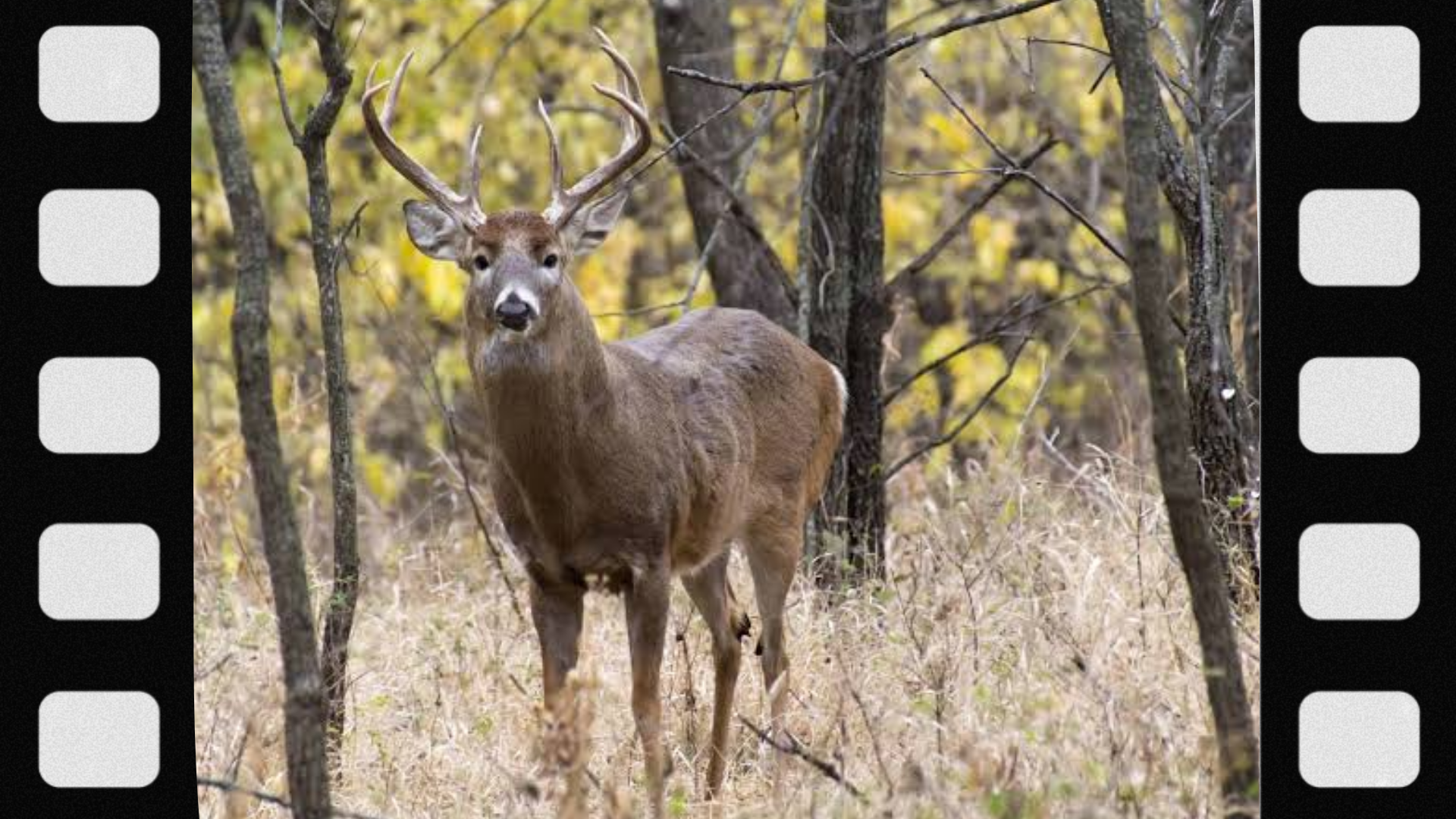
Bucks may expand movement, check doe groups, use downwind edges, or connect bedding areas. Some previously quiet routes become more active, while predictable bed-to-feed patterns can become less consistent. Rubs and scrapes can help interpret movement but do not guarantee timing.
Late season
Energy conservation, secure bedding, thermal cover, and remaining high-quality food often matter more. Deep snow or severe weather may push deer toward easier travel routes. Hunting pressure can make daylight use more cautious or move activity into thicker cover.
Spring and summer
These seasons can reveal how deer use growing vegetation, fawning cover, water, and summer food. However, a summer route may not remain important during hunting season, so treat off-season sign as one layer of evidence.
Wind, Thermals, and Hunting Pressure
Wind does not create a corridor, but it can influence which side of a corridor deer prefer and when they feel secure using it. Terrain can redirect airflow, and daily warming or cooling can create rising or falling thermals on slopes. Real airflow is often more complex than a forecast arrow suggests.
Human pressure can be equally important. Repeated scouting, noisy access, vehicle activity, dogs, farming, hiking, and hunting can shift deer toward alternate routes or later movement. Some deer tolerate routine activity but react strongly to unusual intrusion. A corridor that looks perfect on a map may be poor to hunt if reaching it requires crossing the route, bedding cover, or the destination food source.
Using a Corridor in a Hunting Plan
A travel corridor is most useful when it can be observed or hunted without repeatedly contaminating the route with scent, sound, and movement. Before choosing a position, consider:
- Whether your entry and exit stay away from known bedding and feeding activity
- Whether the wind and terrain allow your scent to move away from the expected route
- Whether you can positively identify the animal and see a safe backstop
- Whether the location is legal for the weapon, season, land designation, and distance from roads or occupied structures
- Whether another hunter, trail, road, livestock area, or property boundary creates a safety concern
- Whether the corridor is broad enough that deer can pass outside your ethical range
- Whether recovery could be completed legally without trespassing
For firearm hunting, treat every firearm as loaded, keep the muzzle pointed in a safe direction, keep your finger outside the trigger guard until ready to shoot, and be certain of the target and what lies beyond it. A mechanical safety never replaces safe handling. For bow or crossbow hunting, follow manufacturer instructions, use compatible equipment, and never dry-fire the bow.
Important Legal and Access Checks
The definition of a deer travel corridor is not location-specific, but scouting and hunting one may involve local rules. Regulations can differ by state, province, wildlife management unit, land manager, season, weapon, and property type. Verify current requirements before going afield, including:
- License, tag, permit, and hunter-education requirements
- Open season, legal shooting hours, and bag limits
- Weapon and ammunition or archery-equipment rules
- Hunter-orange or other visibility requirements
- Trail-camera, baiting, feeding, mineral, and attractant rules
- Tree-stand, ground-blind, marking, and equipment-removal rules on public land
- Vehicle, road, parking, camping, and access restrictions
- Property boundaries and written landowner permission where required
- Game-recovery and tracking-dog rules
Official regulations and emergency orders override general online guidance. Check the current wildlife-agency publication and the rules of the specific public-land unit immediately before scouting or hunting.
Common Beginner Mistakes
Assuming the biggest trail is the best hunting corridor
A large trail can reflect nighttime movement, livestock, hikers, or several wildlife species. Investigate destinations and timing before drawing a conclusion.
Scouting too aggressively
Walking every trail into bedding cover can change the very pattern you are trying to understand. Use maps, observation, legal cameras, fresh weather, and carefully timed checks to reduce disturbance.
Ignoring alternate routes
Deer may have several parallel routes. A wind shift, fallen tree, flood, crop change, or encounter with a hunter can move activity to the next available line.
Confusing sign volume with daylight use
Fresh sign proves recent presence, not necessarily legal-hour movement. Time-stamped observations are more useful than sign alone.
Choosing a location without planning access
A strong corridor is not useful if entering requires walking through it or if leaving after dark disturbs the feeding area. Access and exit should be part of the plan from the beginning.
Forgetting the recovery route
Know property lines, neighboring access, terrain hazards, and legal recovery procedures before taking a shot. Never trespass to follow a deer; contact the landowner and follow local law.
What Not to Do Around a Deer Travel Corridor
- Do not assume every track belongs to a legal target animal.
- Do not shoot at sound, movement, color, or an unidentified silhouette.
- Do not select a position without a safe backstop and a clear view of what is beyond the target.
- Do not cross private property without permission, including during game recovery.
- Do not place cameras, stands, bait, minerals, or habitat alterations where prohibited.
- Do not block a fence opening, road, public trail, or wildlife passage with unsafe equipment.
- Do not cut vegetation or create trails on land you do not own or manage without written authorization.
- Do not climb with a loaded firearm or hold equipment while climbing. Use a full-body fall-arrest system and haul unloaded equipment separately when elevated hunting is legal.
- Do not let a promising corridor push you into unsafe weather, terrain, visibility, or shot conditions.
Can Landowners Create or Improve a Travel Corridor?
On property they own or are authorized to manage, landowners sometimes guide movement by maintaining connected cover, protecting riparian strips, improving habitat edges, opening selected paths, or arranging habitat so food and bedding cover remain linked. These projects can also support broader wildlife connectivity when planned responsibly.
However, cutting trees, applying herbicide, moving soil, altering wetlands or streams, planting nonnative species, or blocking existing routes may require permits or professional advice. A forester, wildlife biologist, conservation district, cooperative extension office, or state wildlife agency can help build a plan that supports habitat rather than creating erosion, invasive plants, or unsafe conditions. Never alter public land without explicit authorization.
Conservation Value Beyond Hunting
Wildlife corridors connect habitat fragmented by roads, development, agriculture, fencing, and other land uses. Connectivity can help animals reach seasonal resources, find mates, disperse, and maintain populations. The Virginia Department of Wildlife Resources, for example, describes wildlife corridors as connections between habitats separated by human activity or infrastructure.
At the scale of one property, protecting creek buffers, hedgerows, timber strips, and safe crossings can maintain movement for deer and other wildlife. Ethical scouting means observing these systems with minimal disturbance, respecting closures and private property, and supporting management that balances wildlife health, habitat, road safety, agriculture, and community needs.
FAQs
1. What is a deer travel corridor in simple terms?
It is a route deer commonly use to move between important places such as bedding cover, food, water, and seasonal habitat.
2. Is a deer travel corridor the same as a deer trail?
Not exactly. A trail is a visible path on the ground, while a corridor is the larger route or habitat band that connects destinations and may contain several trails.
3. How wide is a deer travel corridor?
There is no standard width. A corridor can be a narrow fence opening or a broad creek bottom with multiple parallel trails.
4. What do deer travel corridors connect?
They commonly connect bedding areas, feeding areas, water, thermal cover, escape cover, breeding areas, or seasonal ranges.
5. What terrain features create deer corridors?
Saddles, benches, creek bottoms, ridge systems, gentle slope transitions, fence gaps, cover pinch points, and narrow habitat strips can guide movement.
6. Do deer always take the easiest path?
No. Ease matters, but security cover, wind, disturbance, destination, and individual behavior can make a deer choose a longer or rougher route.
7. Do deer use the same corridor every day?
Sometimes, but not reliably. Weather, wind, food, season, predators, breeding behavior, and human pressure can change the route or timing.
8. Are deer corridors used during daylight?
Some are, while others receive mostly nighttime traffic. Repeated time-stamped observations are the best way to understand local timing.
9. How can I find a deer corridor on an aerial map?
Look for narrow cover connecting larger habitat blocks, field edges, hedgerows, creek drainages, fence lines, and routes linking likely food and bedding cover.
10. How can I find one on a topographic map?
Look for saddles, benches, ridge points, drainages, low crossings, and manageable grades through steep terrain. Confirm every map hypothesis in the field where access is legal.
11. What is a deer funnel?
A funnel is a feature that narrows available movement, concentrating deer into a smaller area. It can be part of a broader travel corridor.
12. What is a pinch point?
A pinch point is a narrow section where terrain, water, fencing, open ground, or habitat shape restricts the routes deer are likely to use.
13. Are creek bottoms good deer travel corridors?
They can be because they may offer cover, water, crossings, and gentler grades. Flooding, steep banks, open vegetation, and human access can reduce their value.
14. Are field edges travel corridors?
Often, especially when cover lies beside food. Deer may walk just inside the cover rather than along the exposed edge.
15. Do bucks and does use the same corridors?
They can, but use may differ by season and individual. During the rut, bucks may connect doe bedding areas or use downwind routes that receive less family-group traffic.
16. Do mature bucks avoid heavily used trails?
Some may use offset, thicker, or less obvious routes, especially under pressure, but this is not a universal rule. Local observation matters more than folklore.
17. What sign confirms a corridor?
No single sign confirms predictable use. Confidence comes from a logical habitat connection plus repeated tracks, droppings, worn trails, camera records, or direct observations.
18. Can rubs identify a travel corridor?
Rubs can support the interpretation that bucks used an area, but a rub line does not prove future daylight movement or the direction a deer will travel.
19. Can scrapes identify a travel corridor?
Scrapes often occur along movement routes, but many are visited irregularly or after dark. Treat them as one clue rather than a guarantee.
20. Where should a trail camera go on a corridor?
Where legal, choose a location that captures several converging trails or a crossing without blocking movement. Minimize disturbance and follow public-land, privacy, labeling, and removal rules.
21. How does hunting pressure change corridors?
Pressure can shift deer into thicker cover, alternate routes, or later movement. Repeated intrusion near bedding or a primary trail may reduce daylight use.
22. How does wind affect a travel corridor?
Wind can influence which edge or parallel trail deer use and whether they feel secure. Terrain and thermals can make local airflow differ from the general forecast.
23. Do corridors change after crop harvest?
Yes. A harvested field can remove food or cover, expose a route, or shift deer toward a different feeding source.
24. Do deer use old logging roads?
They may use quiet roadbeds for easy travel and nearby browse. Regular vehicle or human traffic can change that pattern.
25. Can I create a deer travel corridor?
Authorized landowners can sometimes encourage movement by maintaining connected cover or improving habitat. Get professional guidance and required permits before cutting, spraying, planting, or altering soil or water.
26. Is it legal to cut a trail for deer on public land?
Usually you need explicit authorization, and many public lands prohibit unauthorized cutting or habitat alteration. Check the managing agency’s current rules.
27. Is bait part of a travel corridor?
Bait can alter movement but does not define a natural corridor. Baiting and feeding laws vary widely and may change because of disease management, so verify current local regulations.
28. What is a migration corridor?
It is a larger route animals use between seasonal ranges. It may span many miles and differ from the daily bed-to-feed corridors discussed by most deer hunters.
29. Can roads interrupt deer travel corridors?
Yes. Roads can fragment habitat and create collision risk, although deer may continue using established crossings. Never stop or park unsafely to inspect a crossing.
30. Does finding a corridor guarantee hunting success?
No. A corridor only identifies likely movement. Timing, pressure, wind, access, legal restrictions, visibility, animal behavior, and responsible shot selection still matter.
Final Answer
A deer travel corridor is a recurring movement route that connects useful habitat, such as bedding cover, food, water, secure cover, or seasonal range. It can be a narrow trail, but it is often better understood as a wider landscape connection shaped by cover, terrain, efficiency, and perceived risk. Find one by combining map analysis with several forms of fresh field evidence and repeated observations. Treat the result as a probability rather than a guarantee, minimize disturbance, plan safe access and recovery, and verify all current hunting and land-use rules before entering the field.
Read more: