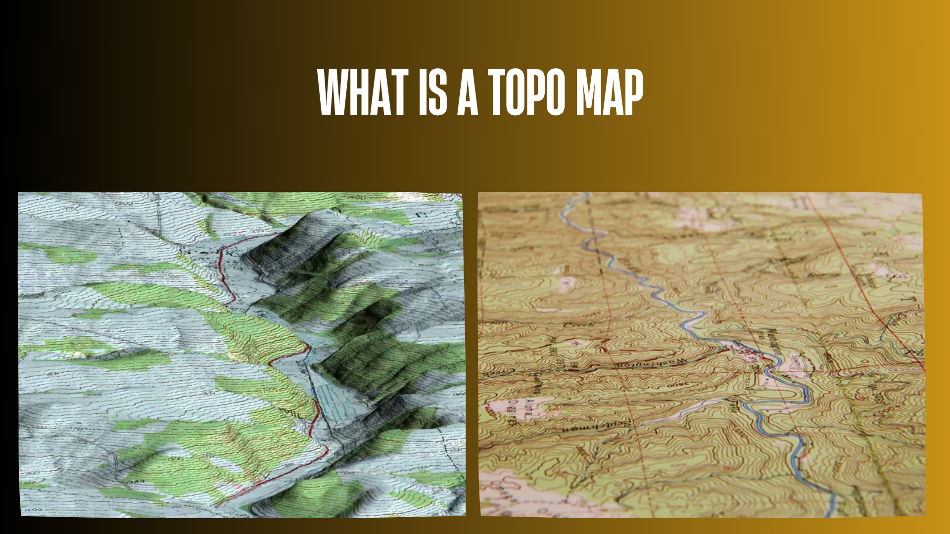

Understanding what is a topo map is an essential skill for hunters, hikers, and anyone traveling through unfamiliar terrain. Unlike a standard road map that mainly shows roads and locations, a topographic map shows the shape of the land, including mountains, valleys, ridges, elevation changes, and natural features.
For hunters, a topo map can provide valuable information before entering the field. It can help identify possible travel routes, steep terrain, water sources, ridgelines, saddles, and areas that may influence wildlife movement. However, a topo map is only a planning tool and does not guarantee animal locations or hunting success.
This guide explains how topographic maps work, how to read contour lines, how hunters use them responsibly, and what beginners should know before relying on one for backcountry navigation.
Quick Answer: What Is a Topo Map?
A topo map, short for topographic map, is a detailed map that represents the three-dimensional shape of the land on a two-dimensional surface. It uses contour lines, elevation markings, symbols, and other map features to show terrain features such as hills, mountains, valleys, streams, and slopes.
Hunters commonly use topo maps to study terrain before a hunt, plan access routes, understand elevation changes, and identify areas where wildlife may travel or rest. A topo map should be used together with other navigation tools, current conditions, and local knowledge.
| Feature | What It Shows | Why It Matters for Hunters |
|---|---|---|
| Contour Lines | Elevation and terrain shape | Shows hills, valleys, ridges, and slopes |
| Elevation Numbers | Height above sea level | Helps understand climbs and terrain difficulty |
| Water Features | Streams, lakes, rivers | Helps with route planning and habitat study |
| Trails and Roads | Access routes | Supports navigation planning |
| Land Features | Ridges, saddles, cliffs | Helps understand terrain structure |
How Does a Topo Map Work?
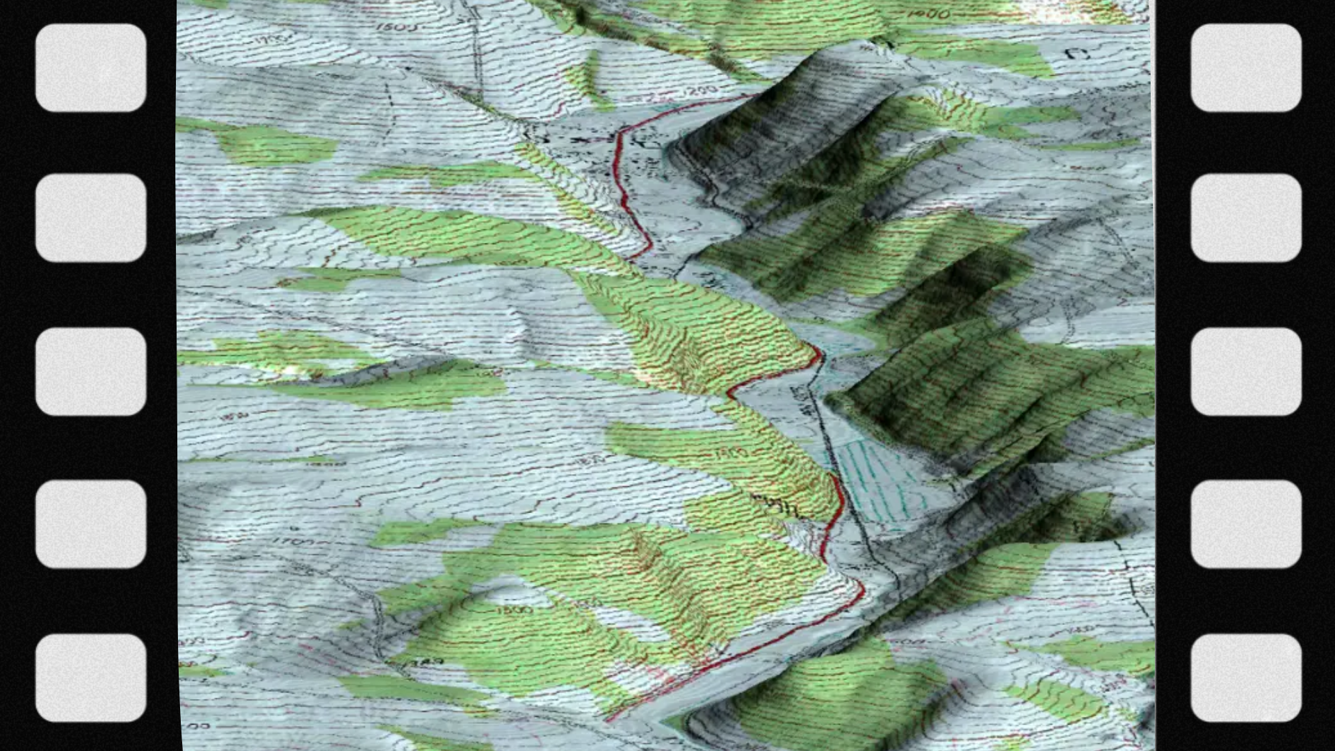
A topographic map works by using symbols and lines to represent features that exist on the actual landscape. Because a flat piece of paper cannot show height directly, topo maps use special markings to communicate elevation and terrain shape.
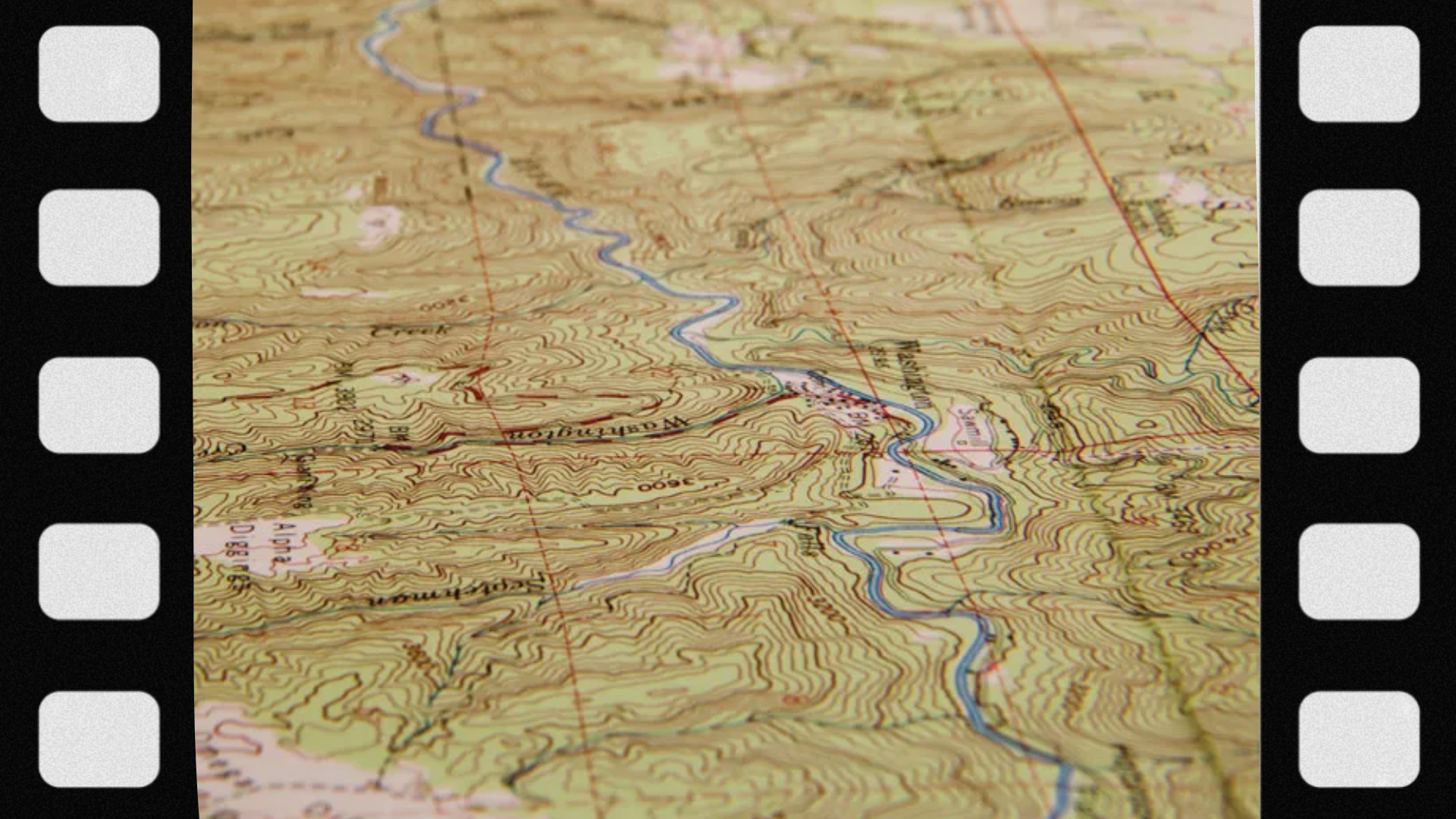
The most important feature of a topo map is the contour line. A contour line connects points that have the same elevation above sea level.
By studying contour lines, a hunter can understand:
- How steep a slope is
- Where valleys and ridges are located
- Where elevation increases or decreases
- Possible travel corridors through terrain
- Areas that may require more physical effort
What Are Contour Lines on a Topo Map?
Contour lines are the foundation of topographic maps. They allow users to visualize terrain without physically standing on the landscape.
Close Contour Lines
When contour lines are close together, the terrain is usually steep. These areas may require more energy to travel through and can create challenging hunting conditions.
Wide Contour Spacing
When contour lines are spread farther apart, the land is generally flatter or has a gradual slope.
Closed Contour Lines
Closed circles often represent hills, mountains, or elevated terrain. The elevation values help determine whether the feature is a small hill or a large mountain.
V-Shaped Contour Lines
V-shaped contour patterns often indicate valleys or drainage areas. The direction of the V can help show the direction water flows.
Why Are Topo Maps Important for Hunters?
1. Understanding Terrain Before the Hunt
Terrain influences how hunters move, where they can safely travel, and how they approach different areas. A topo map allows hunters to study the landscape before entering unfamiliar locations.
2. Planning Safer Routes
Backcountry hunting may involve steep slopes, remote areas, and changing weather conditions. A topo map can help identify difficult terrain and possible travel routes.
3. Studying Wildlife Habitat
Terrain is one factor that influences wildlife behavior. Ridges, valleys, water sources, and vegetation areas may affect how animals move through landscapes.
However, wildlife movement is affected by many variables, including:
- Food availability
- Weather
- Seasonal changes
- Breeding cycles
- Human activity
- Hunting pressure
A topo map helps hunters understand habitat structure, but it cannot predict exactly where an animal will be.
How Do Hunters Use a Topo Map?
| Topo Map Feature | Possible Hunting Application |
|---|---|
| Ridges | Study terrain structure and possible movement areas |
| Saddles | Identify lower points between higher terrain |
| Valleys | Understand drainage and travel routes |
| Water Sources | Plan access and habitat evaluation |
| Elevation Changes | Estimate physical difficulty |
Topo Maps vs Regular Maps: What Is the Difference?
| Map Type | Main Purpose |
|---|---|
| Topo Map | Shows terrain shape and elevation |
| Road Map | Shows roads, cities, and transportation routes |
| Satellite Map | Shows real-world images of landscapes |
| Trail Map | Shows hiking routes and recreational paths |
Many experienced outdoors users combine different map types because each provides different information.
How to Read a Topo Map for Beginners
Step 1: Learn the Map Scale
The map scale explains the relationship between distance on the map and distance on the ground. Understanding scale helps estimate hiking distances and route difficulty.
Step 2: Identify Elevation Information
Look for elevation markings and contour intervals. The contour interval tells you how much elevation changes between contour lines.
Step 3: Find Major Terrain Features
Look for:
- Ridges
- Peaks
- Valleys
- Streams
- Drainages
- Flat areas
Step 4: Plan Your Route
Consider distance, elevation changes, weather conditions, and your physical ability before choosing a route.
What Gear Helps You Use a Topo Map?
You do not need the most expensive equipment to navigate responsibly. Choose gear based on the environment, weather, reliability, and your experience level.
| Gear | Purpose |
|---|---|
| Paper Topographic Map | Backup navigation reference |
| Compass | Direction finding |
| GPS Device | Digital navigation support |
| Phone Mapping App | Convenient digital planning |
| Map Case | Protects maps from weather |
Navigation Safety When Using a Topo Map
A topo map is helpful, but navigation mistakes can happen. Hunters should prepare carefully before entering remote areas.
- Carry backup navigation methods.
- Learn how to use a compass before relying on it.
- Share your planned route with someone before leaving.
- Prepare for changing weather conditions.
- Carry appropriate emergency supplies.
- Do not enter terrain beyond your experience level without preparation.
Common Mistakes Beginners Make With Topo Maps
1. Ignoring Elevation Changes
A short distance on a map may become a difficult journey if the route includes steep climbs or descents.
2. Depending Only on Digital Maps
Electronic devices can be useful, but batteries, weather, or technical problems may affect reliability.
3. Misreading Contour Lines
Understanding contour patterns takes practice. Beginners should spend time learning map symbols before relying on topo maps in remote areas.
4. Assuming the Map Shows Everything
Terrain changes over time. New roads, fallen trees, weather damage, and seasonal conditions may not appear immediately on a map.
What Not to Do When Using a Topo Map
- Do not enter unfamiliar wilderness without preparation.
- Do not rely on a single navigation method.
- Do not ignore weather conditions.
- Do not assume a short distance means an easy route.
- Do not use a topo map as a replacement for local regulations or land information.
- Do not ignore your physical limits.
Final Answer: What Is a Topo Map?
A topo map is a topographic map that shows the shape, elevation, and physical features of the land using contour lines and map symbols. For hunters and outdoor users, it is a valuable planning tool for understanding terrain, choosing routes, and preparing for backcountry conditions.
Learning how to read a topo map improves outdoor awareness, but safe navigation also requires preparation, proper equipment, practical experience, and knowledge of current land-use rules.
FAQs
1. What is a topo map?
A topo map is a map that shows elevation and terrain features using contour lines and symbols.
2. What does topo stand for?
Topo is short for topographic, meaning related to the shape and features of land.
3. Why do hunters use topo maps?
Hunters use topo maps to study terrain, plan routes, and understand landscape features before entering the field.
4. What are contour lines on a topo map?
Contour lines connect locations with the same elevation.
5. How do you read elevation on a topo map?
Elevation is understood by reading contour lines, elevation numbers, and contour intervals.
6. Are topo maps still useful with GPS?
Yes. Many outdoor users combine GPS technology with traditional map-reading skills.
7. Can a topo map show animal locations?
No. It shows terrain, not exact wildlife locations.
8. What is a contour interval?
A contour interval is the elevation difference between contour lines.
9. Are topo maps difficult to learn?
Basic topo map reading can be learned with practice, although advanced navigation requires more experience.
10. What is the difference between a topo map and a trail map?
A topo map focuses on terrain and elevation, while a trail map focuses mainly on routes.
11. Can I use a topo map for backcountry hunting?
Yes, many hunters use them for planning and navigation.
12. Do topo maps show property boundaries?
Not always. Property information should be verified using appropriate land records or official sources.
13. What equipment should I carry with a topo map?
A compass, navigation backup, and weather-appropriate gear are commonly recommended.
14. What do steep contour lines mean?
Close contour lines usually indicate steep terrain.
15. What do wide contour lines mean?
Wide spacing usually indicates gentler slopes.
16. Can topo maps replace a compass?
No. A map and compass work together as navigation tools.
17. Where can hunters get topo maps?
Topo maps are available from many official mapping agencies and outdoor navigation platforms.
18. Are digital topo maps accurate?
Digital topo maps can be useful, but users should understand limitations and verify important information.
19. Do topo maps show water sources?
Many topo maps include streams, lakes, and other water features.
20. Why should beginners learn topo maps?
Understanding terrain improves preparation, navigation ability, and outdoor safety.
Read more: