
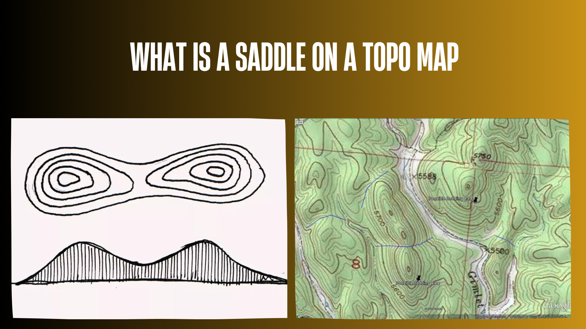

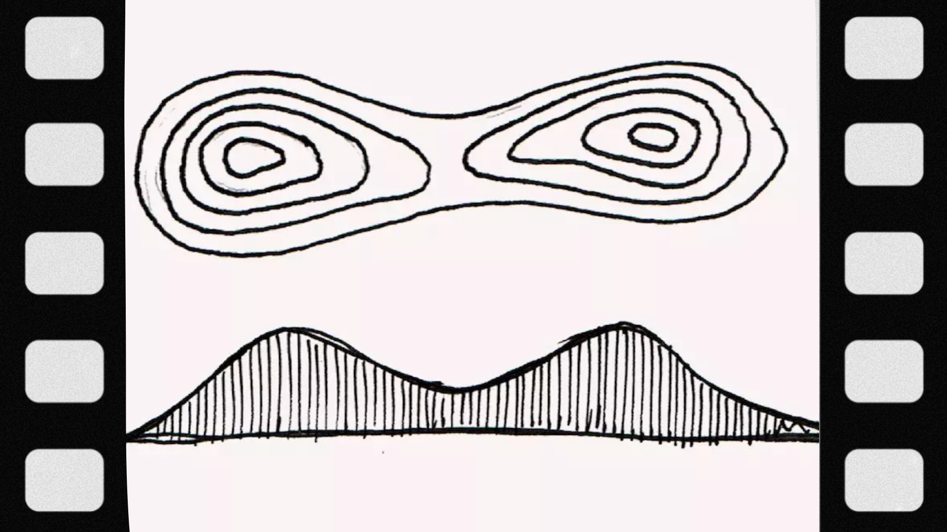
A saddle on a topo map is a low place along a ridge between two higher areas, with lower ground falling away on the other two sides. Its contour pattern often resembles a pinched hourglass between neighboring hills or ridge shoulders. From the saddle, you can generally go uphill in two opposite directions and downhill in the other two. It may provide a useful ridge crossing, but the map shape alone does not establish a safe route, legal access, or reliable wildlife movement.
If you are asking “what is a saddle on a topo map,” the most useful skill is recognizing the surrounding elevations—not simply finding something shaped like an hourglass. This guide explains how to identify the feature, distinguish it from a valley or depression, and use it responsibly when planning a hike or scouting trip.
Picture the Ground Before Reading the Lines
Imagine standing between two nearby hilltops on the ridge connecting them. Walking toward either hill takes you uphill. Turning sideways toward either neighboring drainage takes you downhill. You are standing in a saddle.
The higher areas do not need to be equal-height peaks, and the saddle does not need to be centered between them. It can be a subtle dip in a long ridgeline rather than a dramatic mountain pass.
U.S. Army land-navigation instruction describes the hourglass contour pattern but also notes that unequal surrounding high ground can make the complete shape difficult to recognize. Look for the elevation relationship first.
| From the saddle’s center | What the terrain does |
|---|---|
| Toward one neighboring high point | Rises. |
| Toward the opposite high point | Rises. |
| Across the ridge toward one drainage | Falls. |
| Across the ridge toward the other drainage | Falls. |
These directions follow the terrain. They do not have to align with north, south, east, and west.
How to Find a Saddle on a Topographic Map
1. Check the contour interval and elevation units
A contour line connects points of equal elevation. The contour interval is the vertical difference between successive regular contour levels. Check whether elevations are in feet or meters before interpreting the numbers.
The USGS map-symbol guide explains that labeled, heavier index contours help establish elevation, while closely spaced contours indicate steeper slopes and wider spacing indicates gentler terrain. Contour intervals vary between maps.
2. Find two areas of higher ground
Look for neighboring hilltops or raised sections of a ridge. Hilltops often appear as nested closed contours whose elevations increase inward. Read labels to confirm that you are looking at high ground rather than a depression.
Then examine the connection between those higher areas. A saddle is a candidate where the connecting crest dips.
3. Look for the pinched contour pattern
Contours near a saddle often bend inward from opposite sides, producing an hourglass-like arrangement. The lines associated with the higher ground frame the lower connection between it.
Do not expect perfectly symmetrical curves or a printed figure eight. “Hourglass” describes the overall pattern, not a requirement that contour lines cross at the center.
4. Confirm the slopes on both sides
Trace elevations away from your candidate location. You should find higher ground in the two directions along the ridge and lower ground across it.
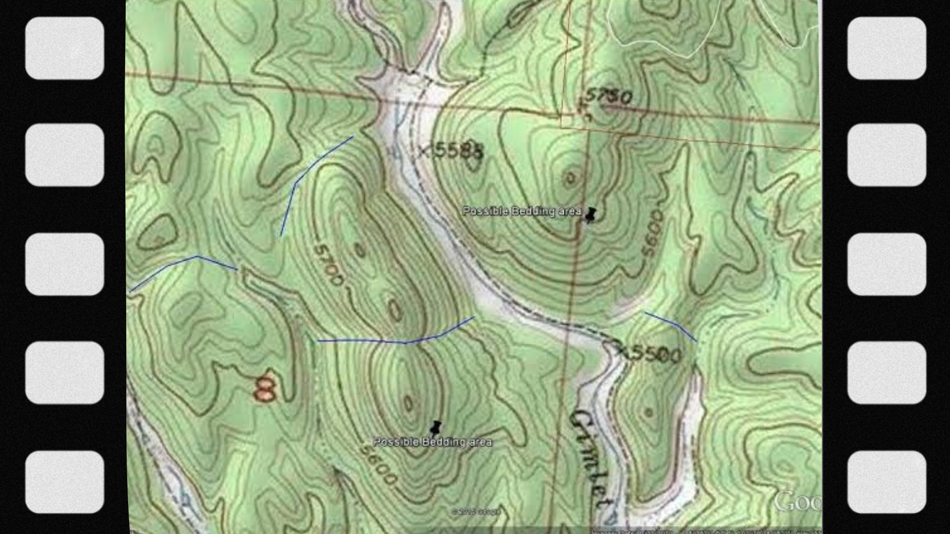
If the ground instead rises all around the center, reconsider whether you are looking at a depression. If the low ground continues along a drainage, you may be following a valley rather than identifying its head at a ridge crossing.
Ordnance Survey’s relief and contour resources provide additional practice interpreting landforms from their contour patterns.
5. Inspect the approaches, not just the center
A saddle may sit between high peaks but still have very steep approaches. Check the full intended route for tightly packed contours, cliffs, stream crossings, and abrupt changes in slope.
Also compare current imagery and land-manager information. Contours describe terrain shape; they do not show every fallen tree, unstable surface, fence, dense thicket, or seasonal hazard.
A Simple Saddle Example
Illustrative example: imagine two hilltops at 1,240 feet and 1,180 feet, connected by a ridge that dips to 1,060 feet. The ground north and south of that dip falls toward separate valleys.
The 1,060-foot location is the saddle. It is lower than the nearby hills but higher than the ground descending away from the ridge.
Now compare two possible journeys:
- Traveling along the ridge: you descend from one hill into the saddle, then climb toward the other hill.
- Crossing the ridge: you climb from one valley to the saddle, then descend toward the valley on the other side.
This explains why a saddle can be both a low point and a high point: it is low along the ridge but high along the crossing route between drainages.
How to Estimate a Saddle’s Elevation
A nearby summit label does not tell you the saddle’s height. Use the contours around the connecting ground, or a spot elevation located specifically at the saddle.
Suppose a map has a 20-foot contour interval. In a simple two-hill pattern, the 1,040-foot contour encloses connected high ground around both hills, while the 1,060-foot contours form separate loops around each hill. If the connecting saddle lies within the lower enclosure but outside both higher loops, its mapped elevation is between 1,040 and 1,060 feet.
That does not establish an exact height of 1,050 feet. It establishes a range. A digital elevation readout may add an estimate, but its precision depends on the underlying terrain data and your selected location.
USGS explains that elevation contours represent equal-height points and allow readers to interpret land shape and slope. The elevation range above is an application of that principle to a hypothetical map, not a measurement from a real location.
Saddle vs. Ridge, Valley, Depression, and Bench
| Feature | Terrain shape | Useful distinction |
|---|---|---|
| Saddle | A dip between higher sections of a ridge. | Higher ground along the ridge; lower ground on both sides. |
| Ridge | An elongated area of high ground. | May contain several high points and saddles. |
| Valley or draw | An elongated low area between slopes. | Generally descends along a drainage direction. |
| Depression | A hollow surrounded by higher ground. | Often shown with inward-facing hachures, or short tick marks. |
| Bench | A relatively gentle shelf interrupting a slope. | Does not require two higher areas with a low connection. |
| Hilltop | A local high point. | Ground falls away around it. |
The surrounding elevations resolve ambiguities better than one isolated curve. For example, a valley’s contour bends generally point toward higher ground, while a projecting ridge or spur bends toward lower ground. Map-reading manuals teach these features together because their relationships help establish the landscape’s overall shape.
Is a saddle the same as a pass, gap, or col?
The terms overlap, but usage varies. A saddle describes the terrain’s shape. A pass commonly refers to a crossing through high ground, often using a saddle. “Col” commonly describes a low connection between mountain summits, while “gap” appears in many regional place names.
Do not treat the name as a route rating. A named pass may still involve difficult terrain, and an unnamed saddle may have no trail.
Why Hunters Notice Saddles
A saddle can be worth investigating because it offers a lower ridge crossing than the nearby high points. The practical scouting question is whether that crossing connects places wildlife actually uses.
Treat this as a scouting hypothesis: if suitable cover and habitat lie on both sides, and the crossing avoids more difficult terrain, a saddle may be part of a travel route. Its shape alone does not prove that deer use it regularly or during daylight.
Research summarized by Mississippi State University’s Deer Lab shows that buck movement includes different behaviors and patterns of space use. That supports evaluating habitat and observations rather than assigning a guaranteed movement pattern to a contour feature.
What to check during legal scouting
- Connections: What habitat lies on either side of the ridge?
- Evidence: Are there tracks, droppings, or trails consistent with the species you are studying?
- Alternatives: Are there other crossings with better cover or easier approaches?
- Disturbance: Do roads, recreation, livestock, or frequent human activity affect the area?
- Access: Can you reach and leave the area legally without crossing restricted property?
A visible trail may serve people, livestock, or several wildlife species. Verify what you can observe and avoid interpreting every path as a dependable deer route.
Do not assume wind will behave predictably
Terrain can redirect airflow, and gaps or passes may experience stronger or more variable winds under some conditions. The National Weather Service’s mountain and valley wind guidance explains how terrain and atmospheric conditions influence local wind.
For scouting, the implication is to check actual conditions rather than assume air always follows the saddle in one direction. A contour map cannot provide a complete local wind forecast.
Using a Saddle for Navigation Safely
A lower crossing can reduce the need to climb over a summit, but the safest route may still follow a longer established trail. Compare the entire journey, including descent and return, rather than choosing the lowest point automatically.
Before leaving, make these checks:
- Verify access and conditions. Consult the land manager for closures, trail conditions, and permitted activities.
- Plan both approaches. Identify difficult slopes, water crossings, exposure, and alternate routes.
- Prepare navigation backups. Download maps, carry a physical map and compass, and know how to use them.
- Set a turnaround plan. Allow for daylight, weather, fitness, and the slowest member of the group.
- Leave a trip plan. Tell someone your route and expected return time.
The National Park Service’s Ten Essentials includes navigation, extra clothing, illumination, first aid, food, water, and emergency shelter. Adapt supplies to the outing and carry a suitable way to communicate in an emergency.
If visibility deteriorates or the terrain no longer matches your interpretation, stop in a safe place and reassess. Do not descend an unfamiliar drainage simply because it appears to lead downhill. The NPS Hike Smart guidance emphasizes route preparation, appropriate equipment, and decisions suited to conditions and ability.
A map feature does not establish permission
A saddle shown inside a broad public-land boundary may still require closer access checks. Confirm ownership, lawful entry routes, closures, and current hunting rules with the relevant agencies. Obtain landowner permission where required.
Even official digital ownership layers have limitations: the Forest Service’s basic ownership map service cautions that its data do not determine legal title, boundaries, or restrictions. A map display is useful planning information, not permission to enter.
Common Saddle-Reading Mistakes
- Looking only for an hourglass: confirm elevation changes around the feature.
- Assuming symmetry: one neighboring hill may be higher or larger than the other.
- Confusing “lower” with “gentle”: a saddle can have steep approaches.
- Ignoring map resolution: small dips and obstacles may not appear.
- Trusting shaded relief alone: read contour labels to confirm which ground is higher.
- Assuming a crossing is a wildlife funnel: verify habitat connections and field evidence.
- Following a waypoint without checking access: coordinates do not establish a legal route.
FAQs
1. What does a saddle look like on a topo map?
It commonly appears as a pinched contour pattern between two higher areas. Confirm that the terrain also descends away on the other two sides.
2. Why is it called a saddle?
Its shape resembles a riding saddle: raised in two opposing directions and lower across the other two.
3. Is a saddle always between two mountain peaks?
No. It can occur between modest hills or raised sections of a ridge. The elevation relationship matters more than the size of the landform.
4. Does a saddle have to be the lowest place on the whole ridge?
No. It is a local low connection between neighboring higher areas. A longer ridgeline may contain several saddles at different elevations.
5. Can a saddle be broad rather than narrow?
Yes. Some are wide and gently rounded; others are sharply defined. A narrow-looking contour pattern is not a universal requirement.
6. Do contour lines cross at a saddle?
You should not expect crossing lines on an ordinary topo map. At the exact saddle elevation, a mathematical contour can have a special meeting pattern, but practical identification relies on the surrounding contour levels.
7. Is there a standard saddle symbol?
Usually, you identify it from contours rather than a dedicated icon. A map may also label a named pass, gap, or saddle.
8. Is a saddle a depression?
No. A depression is surrounded by higher ground. A saddle has lower ground extending away in two directions.
9. Can a saddle have a trail or road through it?
Yes, but many do not. Check the appropriate map symbols and current access information rather than inferring a route from the terrain.
10. Does a saddle contain a stream?
Not necessarily. Drainages often descend away from opposite sides. The saddle itself is a ridge crossing, not automatically a water source.
11. Can I determine its exact elevation from contours?
Often you can only bracket it between contour levels. An appropriately located spot elevation or more detailed elevation data may provide additional information.
12. What do tightly spaced contours near a saddle mean?
They indicate a steep slope in that area. Inspect which side of the feature they describe rather than assuming the whole saddle is equally steep.
13. Can the contour interval hide a small saddle?
Yes. A shallow dip may not cross enough contour levels to produce a clear pattern. Map scale and terrain-data resolution also affect what is visible.
14. Does zooming in always reveal more terrain detail?
No. Enlarging the same data may only make existing lines bigger. More detail requires an appropriate map layer or higher-resolution source data.
15. Are 3D maps useful for understanding saddles?
Yes, as a supporting view. Compare the model with contour elevations, and remember that vertical exaggeration can make slopes appear more dramatic.
16. Are saddles always good deer-hunting locations?
No. A plausible crossing may receive little use, or use may change with habitat conditions and disturbance. Treat the map as a starting point for legal scouting.
17. Can a saddle be dangerous to cross?
Yes. Exposure, snow, ice, unstable ground, weather, or steep approaches can make a lower crossing hazardous. Its elevation relative to nearby peaks does not establish safety.
18. Is a topographic saddle related to tree-saddle hunting?
No. A topographic saddle is a landform. A hunting saddle is equipment used for supported hunting from a tree.
19. Where can I find U.S. topographic maps?
The USGS topoView viewer provides access to topographic maps. Check each map’s date, scale, and coverage before using it for planning.
20. What is the best way to practice identifying saddles?
Choose a familiar area with lawful, easy access. Predict the slopes from the map, then compare them with the ground from an established trail or safe viewpoint.
Final Answer
A saddle on a topo map is a low connection between two higher areas along a ridge, with descending ground on either side. Recognize it by reading elevations and slope relationships, using the hourglass pattern as a helpful clue. Saddles can inform navigation and scouting, but they do not guarantee easy travel or wildlife activity. Confirm conditions, legal access, and current regulations before putting a map-based plan into practice.
Read more: