
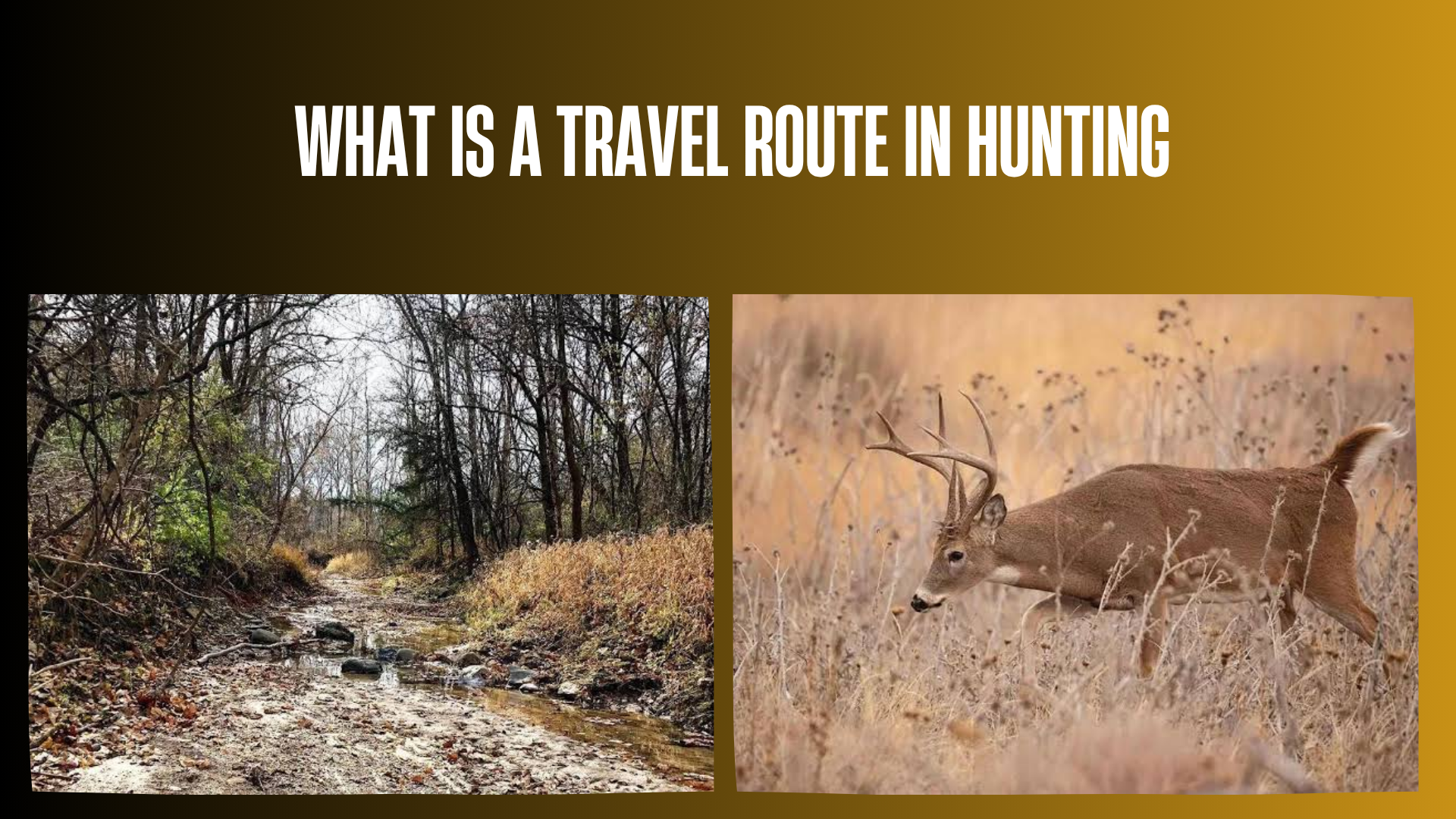

If you are learning to scout deer or other game, you may hear hunters talk about a “travel route,” “travel corridor,” “game trail,” or “runway.” In most hunting conversations, a travel route means a path or general corridor that an animal regularly uses to move between places it needs, such as bedding cover, feeding habitat, water, security cover, or seasonal habitat.
Travel routes matter because wildlife movement is rarely completely random. Terrain, vegetation, food, cover, weather, hunting pressure, and seasonal behavior can influence which paths animals use. However, seeing one trail does not guarantee that animals are using it today, during legal shooting hours, or in the same way throughout the season.
Quick Answer
A travel route in hunting is a path or corridor that game animals regularly use to move through their habitat. For deer, this commonly includes routes connecting bedding cover with feeding areas, water, or other secure habitat. Travel routes may appear as obvious game trails, subtle habitat edges, creek crossings, saddles, strips of cover, or other terrain that makes movement easier. Indiana DNR notes that deer frequently use paths of least resistance and that a well-worn trail with fresh tracks can indicate an active travel route.
Hunters use travel routes mainly as scouting clues. The responsible next step is to confirm current animal sign, check wind and access, verify that hunting is legal at the location, and select only a position with safe visibility and a safe shooting direction.
What Does a Travel Route Mean in Hunting?
In hunting, a travel route usually describes the way an animal moves from one useful part of its habitat to another. It may be a narrow physical trail, but it can also be a broader band of cover or terrain rather than a single obvious track.
For example, a deer may regularly move between thick bedding cover and an agricultural feeding area. The actual travel route might follow a wooded edge, a shallow draw, a creek bank, a saddle between higher areas, or a strip of trees that provides cover between the two locations.
The Missouri Department of Conservation explains that deer often use repeated routes between feeding and bedding areas, creating trails in the process. Some routes follow terrain, skirt openings, parallel waterways, or connect different habitat types.
The term is most commonly used in deer hunting, but the general idea applies to many wildlife species. Animals often move repeatedly between habitat resources, seasonal ranges, escape cover, breeding areas, roosting areas, feeding locations, and water.
Travel Route vs. Travel Corridor vs. Game Trail
| Term | Meaning | What It Tells a Hunter |
|---|---|---|
| Travel route | The general path an animal commonly follows between areas it uses. | Shows where movement may occur. |
| Travel corridor | A broader strip of habitat or terrain that helps animals move from one area to another. | Helps identify a larger movement zone rather than one narrow track. |
| Game trail | A visible path created by repeated wildlife movement. | Provides physical evidence that animals have traveled there. |
| Funnel | A landscape feature that tends to channel movement toward a smaller area. | Suggests where multiple possible routes may narrow. |
| Pinch point | A particularly constricted portion of a travel corridor or funnel. | Shows where movement may become concentrated. |
These terms are often used somewhat loosely by hunters. The important distinction is that a visible trail is evidence of past movement, while a travel corridor describes the larger movement pattern or landscape connection.
How Do Animals Choose Travel Routes?
Animals do not necessarily choose the shortest straight-line path. Their movement reflects a combination of habitat needs, terrain, security, energy use, disturbance, weather, and individual behavior.
Cover
Many game animals prefer routes that allow them to remain close to protective vegetation. A narrow strip of timber, brushy creek edge, hedgerow, or young forest may provide more concealment than an exposed field.
The U.S. Fish and Wildlife Service describes riparian woodland as important wildlife travel-corridor habitat for many species, illustrating how continuous vegetation can help wildlife move across a landscape.
Food
Food availability can influence both where animals move and whether a route remains active. Crop harvest, mast production, changing vegetation, snow, drought, and seasonal forage can all alter movement patterns.
Missouri’s deer scouting guidance recommends asking where a well-used trail leads in relation to food and bedding cover, while noting that changing forage can alter deer movement from year to year.
Bedding and security areas
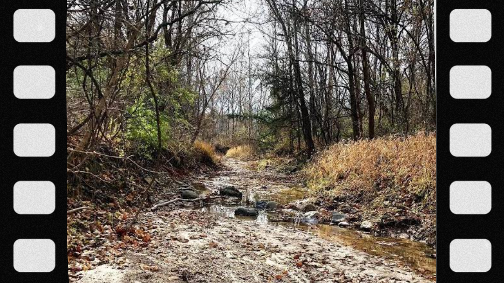
For deer, routes between bedding cover and feeding habitat are especially familiar examples. Minnesota DNR specifically identifies draws, gullies, stream corridors, and similar low areas as potential travel corridors and notes that wooded areas between bedding and feeding locations deserve attention when scouting.
Terrain
Topography can make some routes easier than others. Low points, saddles, shallow draws, benches, creek crossings, and gradual slopes may offer easier passage than steep or exposed terrain.
Indiana DNR advises hunters to study obstacles and terrain features that restrict movement and may create funnels or pinch points, including creek crossings, openings in thick vegetation, and fence gaps.
Hunting pressure and human disturbance
An established route is not permanent. Repeated disturbance, vehicles, logging, hikers, other hunters, agricultural activity, or changes in cover can alter when and where animals move.
This is one reason a trail that looked heavily used during preseason scouting may produce little visible activity once hunting pressure increases.
Season and breeding behavior
Movement can also change during breeding periods, migration, changes in food availability, severe weather, or other seasonal transitions. A route that is important at one time of year may be less active later.
What Does a Deer Travel Route Look Like?
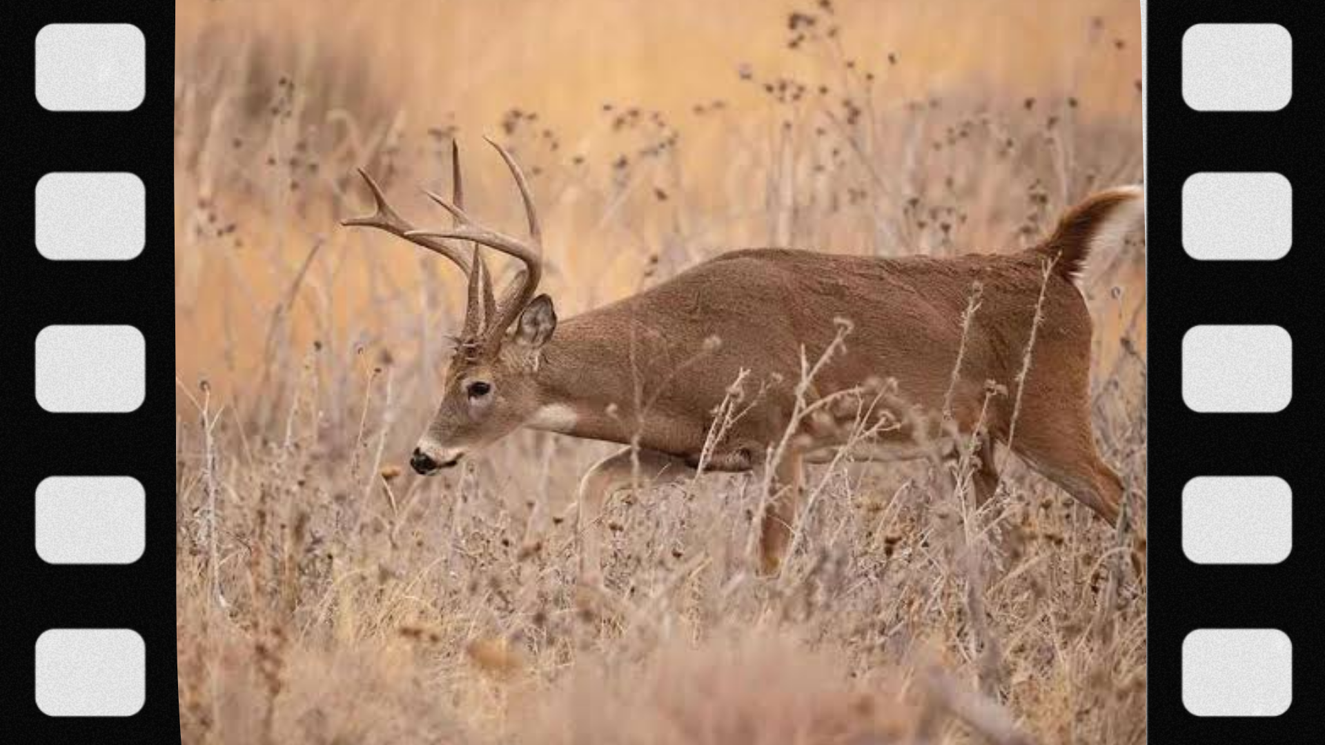
A deer travel route can be obvious, but many are subtle. Good scouting usually involves combining several types of evidence rather than relying on one track or one trail.
Well-worn trails
Repeated hoof traffic may create a narrow path through leaves, grass, mud, or brush. Rhode Island hunter-education material describes deer travel corridors as regular routes that can become well-worn paths resembling narrow human footpaths.
Fresh tracks
Tracks help confirm that an animal has recently passed through an area. Look at multiple tracks and the surrounding sign rather than treating a single print as proof of a high-use corridor.
Multiple trails converging
Several trails joining near a creek crossing, gap, saddle, or other constrained feature can suggest that the landscape is concentrating movement. Ontario hunter-education guidance notes that intersections of game trails can be useful places for hunters to recognize animal movement patterns.
Habitat edges
The transition between mature timber and young growth, woodland and field, wetland and upland cover, or two other habitat types can function as a travel edge. Indiana DNR specifically recommends examining habitat transitions for deer sign.
Creek and drainage crossings
Low banks, shallow crossings, narrow strips between water and steep ground, and natural openings can make travel easier. Tracks in mud can make these locations particularly easy to recognize.
Rubs or scrapes along a line
During the deer breeding season, rubs and scrapes can provide additional clues. Missouri’s scouting guidance notes that linear rub patterns can indicate travel routes, while scrapes can help reveal movement corridors.
Why Are Travel Routes Important to Hunters?
A travel route helps a hunter understand movement rather than simply identifying where an animal has been at some point.
Suppose you find a feeding field with many tracks. That confirms deer visit the field, but it does not necessarily show where they enter it, which route they take, or whether they arrive during daylight. Following the broader movement pattern toward bedding cover can provide a more useful picture.
Illinois Learn to Hunt recommends studying food sources, bedding locations, habitat transitions, terrain, and travel corridors before conducting on-the-ground scouting. Its public-land scouting guidance also emphasizes confirming suspected routes with actual deer sign rather than assuming a good-looking map feature is productive.
How to Find a Travel Route While Scouting
1. Identify destination areas first
Start by asking why an animal would move through the area. For deer, likely destinations may include:
- Food sources
- Bedding or security cover
- Water
- Seasonal habitat
- Breeding-related locations
- Adjacent blocks of cover
Once two important areas are identified, examine the terrain and habitat between them.
2. Study aerial imagery
Aerial photographs can reveal timber strips, agricultural fields, wetland edges, waterways, clear-cuts, brush patches, and other habitat transitions.
Illinois Learn to Hunt uses aerial imagery in its public-land scouting instruction to identify food, bedding cover, travel corridors, and potential pinch points before hunters scout on foot.
3. Read topographic maps
Topographic maps can reveal elevation changes that are less obvious in aerial imagery. Look for:
- Low saddles between higher terrain
- Draws and gullies
- Creek bottoms
- Ridge systems
- Benches or flatter areas on slopes
- Narrow passages around steep terrain
Minnesota DNR highlights low points between higher terrain, including draws, gullies, and stream corridors, as logical deer travel corridors.
4. Confirm the route on the ground
A map shows potential. Tracks and other fresh sign show actual use.
Indiana DNR recommends combining direct observations with reading animal sign and the landscape. Fresh tracks on a well-used trail are stronger evidence than a landscape feature that merely looks promising on a map.
5. Determine where the route leads
Do not stop scouting simply because you find a trail. Ask:
- Does it connect to food?
- Does it lead toward bedding cover?
- Does it cross water?
- Does it connect two blocks of security cover?
- Does it disappear into open habitat?
- Does it appear to be primarily an escape route?
6. Look for current rather than historical use
A deep trail may have been created over many years, yet it may not currently receive heavy use. Fresh tracks, recently disturbed leaves, current browse, recent rubs or scrapes, and repeated observations provide more useful evidence of present activity.
Travel Route vs. Funnel: What Is the Difference?
A travel route tells you where animals move. A funnel describes a landscape feature that may channel that movement.
For example, deer may have a general travel corridor connecting bedding cover with a feeding area. Halfway between the two, a pond and steep bank may narrow the available cover to one smaller passage. The larger movement zone is the travel corridor; the narrowing feature is the funnel; its tightest section may be called a pinch point.
Indiana DNR identifies features such as creek crossings, openings in dense briars, and gaps in fences as examples of terrain or obstacles that can restrict deer movement and create funnels or pinch points.
Travel Route vs. Bedding Area
A bedding area is where an animal rests or seeks security. A travel route connects that area with another part of its habitat.
For a beginner, confusing the two can lead to unnecessary disturbance. Walking through dense bedding cover repeatedly while scouting can change local movement patterns, especially in heavily hunted areas.
A more conservative approach is to learn how routes enter and leave security cover while minimizing unnecessary intrusion.
Travel Route vs. Feeding Area
A feeding area is a destination. The travel route is how the animal gets there.
This distinction matters because animals may use a feeding area when hunters are not present or after legal hunting hours. A trail connecting the food source with daytime cover can therefore sometimes provide more useful scouting information than tracks in the feeding area itself.
What Is a Primary Travel Route?
Hunters sometimes use “primary travel route” to describe a well-used route that appears to receive more regular traffic than nearby secondary trails.
Possible clues include:
- More numerous tracks
- A more defined trail
- Several smaller trails merging into it
- Repeated fresh sign
- A logical connection between major habitat features
However, trail width alone does not tell you which animals are using it or when. A heavily worn path may be used by multiple species or mainly after dark.
What Is a Secondary Travel Route?
A secondary route is generally a less-used alternative path. It may branch from a major trail, parallel it through thicker cover, or provide access to a smaller food source, bedding pocket, or escape area.
Secondary routes can become more important when animals react to disturbance, weather, seasonal changes, or hunting pressure.
Do Bucks and Does Use the Same Travel Routes?
Sometimes, but not always.
Deer movement varies by sex, age, season, breeding behavior, food availability, habitat, and individual animal. During some parts of the year, bucks may use routes associated with security cover or breeding activity that differ from heavily used family-group trails.
During the rut, buck movement may also become less predictable as animals search for receptive does. A trail should therefore be treated as evidence of movement, not proof that a particular buck will use it.
Do Travel Routes Change During the Rut?
They can. Breeding activity may change how frequently deer move, which routes males use, and when movement occurs.
Some established feeding-to-bedding routes continue to be important, while other routes become more active as bucks check areas used by does. Rub lines, scrapes, trail intersections, and routes connecting pockets of cover may become more noticeable.
No rut feature guarantees daytime activity, however. Individual behavior and local hunting pressure still matter.
How Does Hunting Pressure Affect Travel Routes?
Hunting pressure can change both timing and route selection. Wildlife may begin using thicker cover, alternate routes, less accessible terrain, or different travel times when disturbance increases.
This explains why preseason sign should not be treated as a permanent prediction. Continue observing conditions once the season begins.
Public-land access patterns can be especially important because parking areas, established walking routes, and other hunters may influence where animals experience disturbance.
How Does Wind Affect a Travel Route?
Wind does not necessarily determine the physical route, but it can influence how animals use an area and whether a hunter is detected.
Hunter-education material emphasizes considering prevailing wind when choosing a stand because many game animals rely strongly on scent.
Wind direction can also change because of terrain, thermals, vegetation, and weather. Avoid assuming a single compass direction will behave identically throughout the day.
Can Trail Cameras Help Confirm a Travel Route?
Where legal, trail cameras can help establish whether a suspected route is currently being used and at what general times animals pass through.
They are particularly useful when combined with physical sign rather than used alone. A camera covering one trail shows only a small portion of the surrounding landscape.
Trail-camera regulations vary by jurisdiction and can change, especially on some public lands. Always check the current wildlife-agency and land-management rules before placing one.
Are Travel Routes the Same Every Year?
No. Some landscape-driven routes may remain useful for many years, especially where terrain creates a natural crossing. Others may change significantly.
Movement can shift because of:
- Crop rotation
- Mast availability
- Logging or timber growth
- Flooding or drought
- New roads or development
- Changes in hunting pressure
- Predator activity
- Snow conditions
- Seasonal vegetation
- Changes in bedding cover
Missouri’s wildlife agency specifically notes that changes in available forage can alter deer movement from year to year.
Common Beginner Mistakes When Reading Travel Routes
Assuming the biggest trail is automatically the best
A large trail may have accumulated use over months or years. Check for current tracks and other recent activity.
Ignoring where the trail goes
A trail is more useful when you understand what it connects. Trace the movement pattern conceptually between food, bedding, water, or other cover.
Confusing animal travel with daylight activity
Fresh sign shows that animals use the route. It does not automatically reveal the exact time they use it.
Overlooking secondary trails
Animals do not always use the most obvious path. Alternate trails through thicker cover may become more important as pressure increases.
Scouting too aggressively
Repeatedly walking through bedding or security cover can add disturbance and may change the very movement pattern you are trying to understand.
Ignoring wind and access
A good-looking travel route is not necessarily a good hunting location if reaching it requires disturbing the area or if the position creates poor wind or unsafe visibility.
Assuming old sign predicts the current season
Food, cover, land use, and pressure change. Verify fresh activity each season.
Safety and Legal Considerations Around Travel Routes
Finding an active route does not automatically mean it is legal or safe to hunt there.
- Verify that hunting is permitted on the property and in that specific area.
- Know property boundaries and obtain landowner permission where required.
- Check current species, season, weapon, licensing, tag, hunter-orange, and public-land regulations.
- Do not assume a trail near a road, building, parking area, trail, livestock, or neighboring property provides a safe hunting position.
- Positively identify the target before considering any shot.
- Know what is beyond the target and use only a safe shooting direction.
- Do not trespass to scout, hunt, or recover game.
- Follow any restrictions on trail cameras, stands, blinds, bait, electronic equipment, or access.
Official regulations always override general hunting advice. Requirements vary by state, province, wildlife-management unit, property type, season, and hunting method.
What Beginners Should Remember About Hunting Travel Routes
The most useful way to think about a travel route is as part of a larger habitat pattern. Do not focus only on a line of tracks.
Ask four questions:
- Where is the animal coming from?
- Where is it likely going?
- Why does this route make sense based on cover and terrain?
- Is there fresh evidence that animals are still using it?
If those questions produce a logical and evidence-based answer, you are beginning to understand the area’s movement pattern rather than simply following a trail.
FAQs
1. What is a travel route in hunting?
A travel route is a path or corridor that game animals commonly use to move between important habitat areas such as bedding cover, feeding areas, water, and security cover.
2. Is a travel route the same as a game trail?
Not exactly. A game trail is a visible path formed by repeated animal movement. A travel route may include that trail but can also describe a broader movement corridor.
3. What is a deer travel corridor?
A deer travel corridor is a band of terrain or habitat that deer commonly use when moving between locations. Examples can include wooded strips, draws, creek bottoms, field edges, and other connected cover.
4. What is a deer funnel?
A funnel is terrain or habitat that narrows possible animal movement into a smaller area. Indiana DNR gives examples such as creek crossings, openings in dense cover, and gaps in fences.
5. What is a pinch point in deer hunting?
A pinch point is a particularly narrow part of a potential travel corridor where terrain or habitat restricts the available paths.
6. Where do deer travel between bedding and feeding areas?
Routes vary by property, but deer may use draws, creek corridors, field edges, timber strips, habitat transitions, saddles, and other areas that provide convenient or covered movement. Minnesota DNR identifies several of these terrain types as potential travel corridors.
7. How can I tell if a deer trail is active?
Look for multiple types of fresh evidence, such as recent tracks, newly disturbed leaves or soil, current browse, recent rubs or scrapes, direct observations, or repeated trail-camera detections where cameras are legal.
8. Does a heavily worn deer trail mean lots of deer use it?
Not necessarily. A worn trail can represent long-term use, nighttime use, or movement by multiple wildlife species. Current sign matters more than trail depth alone.
9. Do deer always take the path of least resistance?
No behavior is absolute, but state wildlife agencies commonly note that deer often favor easier travel where other needs such as security and cover are also met. Indiana DNR specifically advises scouts to look for this pattern.
10. Do deer use the same travel route every day?
Not necessarily. Weather, wind, disturbance, food availability, breeding behavior, predators, and hunting pressure can all alter movement.
11. Do deer use the same routes in morning and evening?
Sometimes, but direction, timing, and exact trails may differ. Do not assume that a route used toward food in the evening will produce identical movement the next morning.
12. Do bucks use different travel routes than does?
They can. Sex, age, breeding season, individual behavior, and security needs can all influence route selection.
13. How does the rut change deer travel routes?
Bucks may increase movement and use routes that help them encounter does. Established habitat corridors can remain important, but breeding activity can also make movement less predictable.
14. Can a creek be a deer travel corridor?
Yes. Depending on terrain and vegetation, deer may travel along creek edges or cross at convenient locations. Creeks can also create pinch points when surrounding terrain restricts movement.
15. Are saddles good deer travel routes?
They can be. A saddle is a lower section between higher terrain, and animals may use it as an easier crossing. Minnesota DNR recommends paying attention to low areas between higher ground when scouting travel corridors.
16. Do deer follow field edges?
They often can, particularly where edge habitat offers food, cover, or a convenient transition between habitat types. Indiana DNR recommends examining habitat edges for deer sign.
17. What does an intersection of deer trails mean?
It can indicate that several movement paths converge, but it does not automatically mean the location is heavily used during hunting hours. Check fresh sign and determine where the trails lead.
18. Can rub lines show a buck travel route?
They can provide clues. Missouri’s scouting guidance notes that linear rub patterns may indicate buck travel routes, but individual rubs should not be treated as proof of a predictable movement schedule.
19. Do scrapes identify travel routes?
A series of scrapes may help reveal a corridor used by deer, particularly during breeding season. However, scrape activity varies and may occur when hunters are not present.
20. Can I find travel routes using satellite maps?
Yes. Aerial imagery can help identify timber strips, habitat edges, agricultural fields, waterways, and other features that may influence movement. Ground scouting should then confirm actual use.
21. Are topographic maps useful for finding deer routes?
Yes. They can reveal saddles, draws, gullies, ridges, creek bottoms, and steep terrain that may influence how animals move.
22. Should I follow a deer trail while scouting?
Following a trail during appropriate preseason or off-season scouting can help determine what habitat it connects, provided you have legal access and avoid unnecessary disturbance to sensitive areas.
23. Can hunting pressure move deer off a travel route?
Yes. Increased disturbance can alter route choice and movement timing, especially in heavily hunted areas.
24. Do deer travel routes change when food sources change?
Yes. Missouri’s wildlife agency notes that changes in available forage can alter deer movement between years.
25. Is every travel route a good hunting location?
No. The location also needs lawful access, fresh animal activity, safe visibility, an appropriate wind and access plan, and a safe shooting direction.
26. Can a travel corridor be wider than one trail?
Yes. A corridor may include several parallel or branching trails within a broader strip of favorable habitat.
27. What is a primary deer trail?
Hunters generally use the term for a relatively well-used route that appears to carry more regular movement than nearby secondary paths. It is an informal hunting term rather than a strict scientific category.
28. What is a secondary deer trail?
A secondary trail is usually a less-used route that branches from or parallels a more prominent path. Its importance can increase when conditions or hunting pressure change.
29. Are wildlife migration corridors the same as hunting travel routes?
They are related but not identical concepts. Wildlife-management agencies often use “migration corridor” for large-scale seasonal movement between ranges, while hunters commonly use “travel route” for more localized day-to-day movement within a hunting area. Federal land-management documents use wildlife travel corridors in the broader landscape-connectivity sense.
30. What is the most important thing to remember about a travel route?
A trail or corridor shows potential movement, not guaranteed hunting success. Confirm current sign, understand where the route leads, minimize unnecessary disturbance, hunt only where legal, and always prioritize safe target identification and a safe background.
Final Answer
What is a travel route in hunting? It is a path or broader corridor that game animals regularly use to move between important habitat areas such as bedding cover, feeding areas, water, security cover, or seasonal habitat. For deer, travel routes commonly follow game trails, wooded edges, draws, creek corridors, saddles, and other terrain that makes movement practical or provides cover.
The key is not simply finding a trail but understanding where it leads and confirming that animals are currently using it. Fresh sign, terrain, food, bedding cover, wind, seasonal behavior, and hunting pressure all help explain the pattern. Any hunting location must also provide legal access, positive target identification, and a safe shooting direction, and current regulations should always be checked with the applicable wildlife or land-management agency.
Read more: